![]()
Around Cisternes
Cisternes-la-Forêt
 Dogs allowed
Distance 9Km
Duration 2h45
Hiking route BOUCLE
Marking Yellow
In pictures
Route description
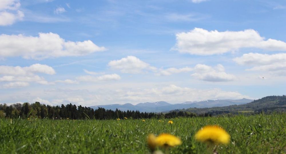
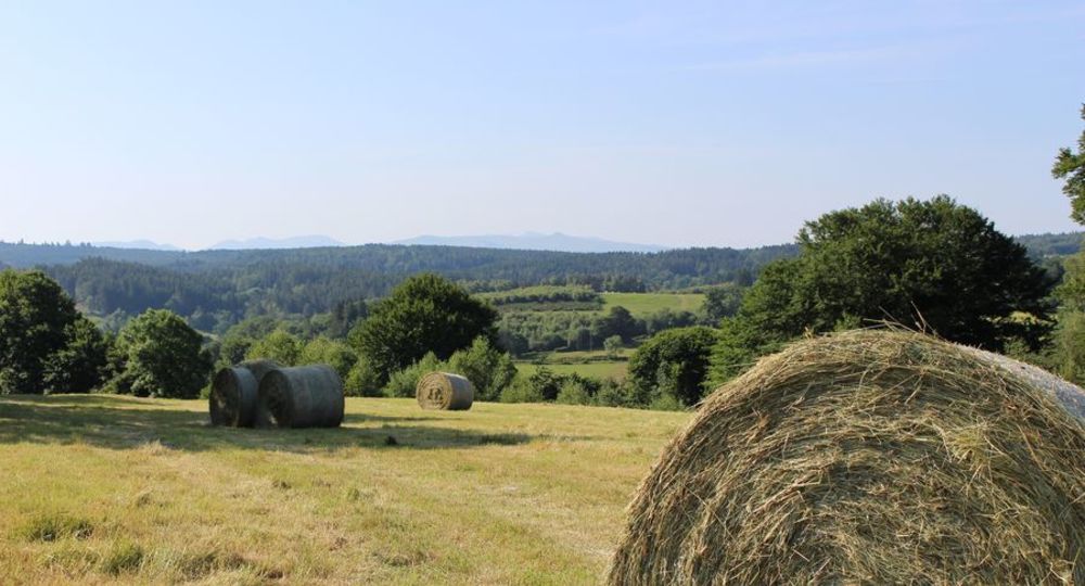
This walk offers magnificent views of the Chaîne des Puys, set against a backdrop of hedged farmland, rivers and forests typical of the Combrailles region.
Trail highlights
Former Faublanc fountain.
Guidebook with maps/step-by-step
Step 1 : Go up and turn left onto the D61. At the fountain, turn left and, after the pond, continue left to a crossroads.
Step 2 : Go up to the right and continue straight on. At the crossroads, turn right. After 100 m, leave the dirt track and turn right onto a grassy path at the edge of the wood. Follow the path and the edge of the field to a dirt track. Turn left to reach a road. Cross the road, turn right and immediately left onto a track. At the fork in the road, turn right and go straight ahead until you reach an intersection. Go right through the forest to a road.
Step 3 : Turn right for 1 km, and at the crossroads, turn left onto the dirt track. At the fork, go right to a road. Cross it and go straight ahead (towards Marsèche) for 200 m ; turn right onto the track. Continue straight ahead through the forest to the crossroads, then turn left. Descend to the Faublanc houses.
Step 4 : Turn left and go straight ahead on a track. At the fork, turn right onto a road. Just before the road, fork left onto a path running parallel to the road. Continue straight ahead on a grassy path and at the crossroads, turn left, cross the D61 and rejoin the starting point.
Proposed and managed by the Conseil départemental du Puy-de-Dôme – PDIPR.
/* col-6_sm-12 */ ?>
Opening hours
From 01/01 to 31/12 daily.
Subject to favorable weather.
Comfort, facilities and services
- Pets welcome
Additional information
For your own safety, always take a bottle of water, a hat, warm clothing and footwear suitable for walking.
Depending on weather conditions, certain itineraries are not recommended in bad weather (fog) or are not practicable, or even forbidden, during the winter season.
Some sites are fragile, so stay on the marked trails. Avoid picking wild flowers and disturbing wildlife. Pick up your garbage.
Animals are not allowed on some routes.
Dogs allowed Dogs must be kept on a leash due to the presence of herds.
Environment
In the country, Forest location, Presence of livestock and guard dogs
Access
From Pontgibaud (west of Clermont-Ferrand) follow signs for Pontaumur as far as La Goutelle. Turn left onto the D61 to reach Cisternes-La-Forêt. The starting sign is in front of the church and the salle polyvalente.
Downloadable :
Photo credits : Office de Tourisme des Combrailles, Office de Tourisme des Combrailles