![]()
Bane and Anzelle
Cournon-d’Auvergne
 Dogs allowed
Distance 13Km
Duration 3h45
Hiking route BOUCLE
Marking Yellow
In pictures
Route description
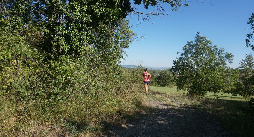
Between Cournon and Lempdes, Anzelle and the puy de Bane form a very rich natural area. Once covered by vineyards, the puy d’Anzelle is home to over 250 plant species and sixty butterfly species.
Trail highlights
– View of the Chaîne des Puys, Gergovie, Sancy.
– Puy de Bane (panorama).
– View of the Livradois mountains, Puy Saint Romain.
– View of Cournon and the Val d’Allier.
– Church of Saint-Martin, a historic monument.
Guidebook with maps/step-by-step
Step 1 : Take the long path from the parking lot and turn right at the second intersection.
Step 2 : Take the path that climbs to the left. 300 m further on, turn right onto the path that winds its way up towards the puy d’Anzelle until you reach the path that runs around the puy.
Step 3 : (Shortcut to the right to reach point 4). Turn left, leaving the paths on either side. At the T junction, turn left, passing under a high-voltage power line (view of the Chaîne des Puys). At the first crossroads, turn right ; at the next two crossroads, go straight ahead. After the storm basin, take the first right. At the next two T-junctions, turn left, down towards Lempdes on chemin de la Limenaire, then right into rue des Vaugondières. At the traffic circle, enter the town hall park and follow the path along the wall to the park’s upper exit (you can leave from the media library parking lot, then cross the park to reach the upper exit).
Step 4 : Turn opposite rue de la Source and climb rue du Crest. Continue along the path opposite, passing under a high-voltage power line and continuing uphill, ignoring the next two intersections. Rejoin the plateau until you reach a junction of six paths.
Next step
Step 5 : Take the first track on the left (shortcut on the right to get back to point 2) (view of Gergovie, the Chaîne des Puys, the Sancy). Follow a pine wood (view of Limagne). Leave a track on the right. At the end of the wood, turn right at the fork, then right again to reach the summit of Puy de Bane (panorama). (Orientation table on left, 5 min. round trip). At the summit (marker 543), take the left-hand path down to join a wide track on the left. Stay on this main path as you descend towards Cournon (view of the Livradois mountains, Puy Saint Romain), as far as Place de La Croze (view of Cournon and the Val d’Allier).
Step 6 : Turn right up rue du Chemin Blanc (view of the historic church of Saint-Martin) to reach the hills, leaving a path to the left and then to the right. At the crossroads, go straight ahead and turn left at the next fork. At the next three intersections, continue straight on to the bottom of the slope. Continue straight ahead to reach the starting point.
Proposed and managed by the Conseil départemental du Puy-de-Dôme – PDIPR.
/* col-6_sm-12 */ ?>
Opening hours
From 01/01 to 31/12 daily.
Subject to favorable weather.
Comfort, facilities and services
- Pets welcome
Additional information
For your own safety, always take a bottle of water, a hat, warm clothing and footwear suitable for walking.
Depending on weather conditions, certain itineraries are not recommended in bad weather (fog) or are not practicable, or even forbidden, during the winter season.
Some sites are fragile, so stay on the marked trails. Avoid picking wild flowers and disturbing wildlife. Pick up your garbage.
Animals are not allowed on some routes.
Dogs allowed All dogs must be kept on leashes because of the presence of herds.
Environment
In the country, Mountain view, Close to a public transportation, Presence of livestock and guard dogs
Access
At the western entrance to Cournon, at the Anne-Marie Menut traffic circle, take the “Parking” exit. Park here. Start sign at end of parking lot. (Alternative departure point : in Lempdes, at the Médiathèque parking lot in the town hall grounds. Bus lines 35 and 36, Mairie stop).
Downloadable :
You might also like…
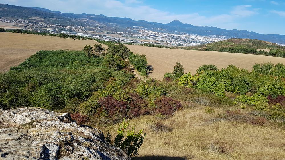
Photo credits : ESM-CAT