
From Auzon to Gondole
Le Cendre
 Dogs allowed
Distance 9.5Km
Duration 2h45
Hiking route BOUCLE
Marking Yellow
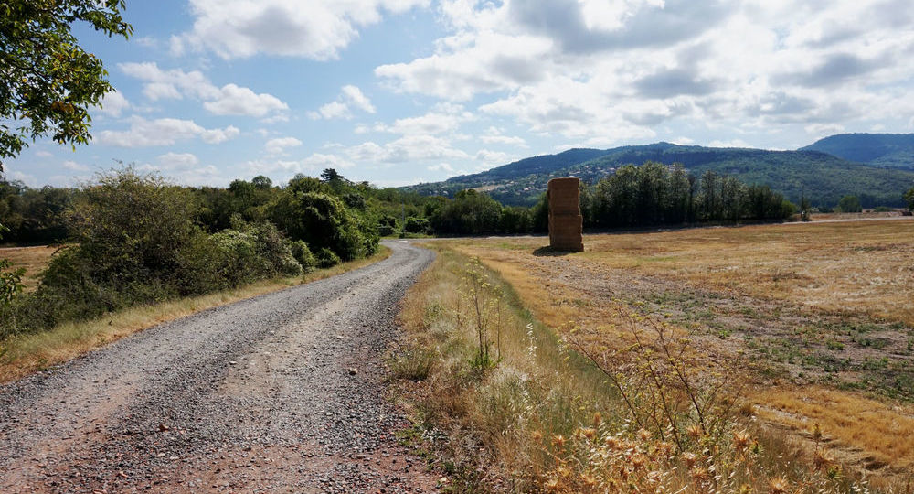
In pictures
 Visitor alert
Route not accessible from March 30 to May 6, 2026 :
Due to construction work, the Caesar Bridge, which crosses the railroad line, will not be accessible to hikers from March 30 to May 6, 2026.
Route description
Following the Auzon river, which meanders from west to east, this trail allows you to enjoy the richness of the local natural heritage. Lulled by the sound of the water and the greenery, nature-lovers will succumb to the charm of this green setting.
Trail highlights
– Coulée Verte.
– The Auzon riverbank.
– Puy de Marmant (panoramic viewpoint).
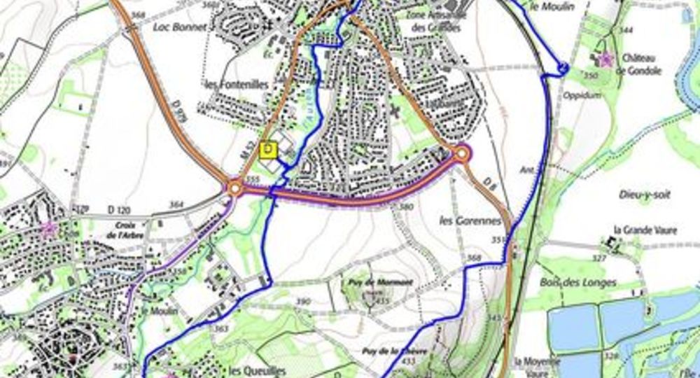
Guidebook with maps/step-by-step
Step 1 : From the start sign, enter the stadium, walk alongside the gymnasium and follow the Coulée Verte signs. Cross the Auzon and turn left. Follow the Auzon riverbank to a road. Turn right into Avenue du Stade. After the bus shelter, turn left onto the Coulée Verte. Cross the route des Martres and continue along the Coulée Verte. Follow the river Auzon as far as the SNCF bridge after a large playground.
Step 2 : Pass under the bridge, cross Avenue Nouvelle, then the Auzon. Turn left, following the stream. At the Auzon bridge, cross the road and continue along the bank. One hundred meters after the last houses, leave the stream, and climb the path parallel to the railroad, until you reach a T-junction.
Step 3 : Turn right to cross the railroad (before crossing the bridge, 50 m to the left : information on the Gondole archaeological site). Immediately turn left and follow the track to a road. Cross the road and continue along the path opposite. After 100 m, turn right up a road that becomes a wide track. At the first crossroads, turn left onto a wide, gravelled track that climbs steadily to the summit, where there are 2 antennas (just before, a short 50 m round-trip to the right for a 360° view : PV2). Continue and turn right onto the first grassy path leading downhill. At the next crossroads, turn left onto a wide carriageway as far as a T-junction. Turn right onto the small asphalt road leading downhill to the crossroads (before the PV3 crossroads : Vierge de Monton, Le Crest, Gergovie and Orcet).
Step 4 : Go right to a road. Cross it, and go straight ahead on a road that becomes a carriageway. At the fork, take the track on the right. At the next fork, go left. At the crossroads, go left as far as the road. At the road, take the left-hand path to the Auzon. Pass under the road bridge, around the retention basin, and continue along the bank to the footbridge. Use the footbridge to return to the starting point.
Proposed and managed by the Conseil départemental du Puy-de-Dôme – PDIPR.
Opening hours
From 01/01 to 31/12 daily.
Subject to favorable weather.
Comfort, facilities and services
- Pets welcome
Additional information
For your own safety, always take a bottle of water, a hat, warm clothing and footwear suitable for walking.
Depending on weather conditions, certain itineraries are not recommended in bad weather (fog) or are not practicable, or even forbidden, during the winter season.
Some sites are fragile, so stay on the marked trails. Avoid picking wild flowers and disturbing wildlife. Pick up your garbage.
Animals are not allowed on some routes.
Dogs allowed All dogs must be kept on leashes because of the presence of herds.
Environment
Presence of livestock and guard dogs
Access
South of Clermont-Ferrand, on the A75, take exit 4 towards Le Cendre. Reach the Le Cendre parking lot near the Jean Jaurès stadium.
Photo credits : ESM-CAT, ESM-CAT
 Updated on 29 May 2026 by Conseil départemental du Puy-de-Dôme