
From spring to wobbly stone
Montcel
 Dogs allowed
Distance 11Km
Duration 3h15
Hiking route BOUCLE
Marking Yellow
In pictures


Route description
From the village of Montcel, you can explore the ruins of Montcel castle, the panorama of the Livradois and the Chaîne des Puys and the Pierre Branlante site.
Trail highlights
La Pierre Branlante
Guidebook with maps/step-by-step
Step 1 : Take the right-hand path and climb to a T-junction (view of Livradois-Forez, Combronde, Puy de Dôme, Montcel). Turn right. At the crossroads, continue straight ahead. At the fork in the road (waste disposal site), turn left, cross the road and go straight ahead. When you see the houses, continue in their direction and enter Le Peyroux as far as the T-junction.
Step 2 : Turn left, then, at the next crossroads, left onto the road for about 100 m, then right onto “rue des Jouffrets”. At the bend after the farmhouse, take the left-hand path down to the Aise stream. Cross the ford, turn right and climb the steep wooded path. After a flat area and another climb, when the path begins to descend slightly, leave it and go right. At the houses, take the “Chemin de Côte Meunier” road. At the bend in the road, continue straight ahead on “chemin de la Pierre branlante”. At the fork, stay on the edge of the forest. Near a megalithic site, continue along the path and, at the sign for the stone, take the path to the right to reach the Pierre branlante, 100 m away.
Step 3 : Make a U-turn to return to the signpost and turn right. Descend to the stream, cross the ford and climb up to the hamlet of Les Jouffrets. At the fork in the hamlet, turn left up “rue des Jouffrets” (several wells). At the crossroads, turn left onto the road (signposted Laligier, La Tour Serviat) for 50 m, then turn right onto the track. At a private pond, turn left along the edge of a meadow and, at the top, continue to the edge of a forest. Continue straight ahead on the path, which descends rapidly. At the T-junction, turn right. At the stop sign, take the road on the left for 30 m, then go down the path on the right. Rejoin the road and, before the church, return to the starting point.
Opening hours
All year round daily.
Comfort, facilities and services
- Pets welcome
Additional information
For your own safety, always take a bottle of water, a hat, warm clothing and footwear suitable for walking.
Depending on the weather conditions, some routes are not recommended in bad weather (fog) or are not practicable, or even forbidden, during the winter season.
Some sites are fragile, so stay on the marked paths. Avoid picking wild flowers and disturbing wildlife. Pick up your rubbish.
Animals are not allowed on some routes.
Dogs allowed Dogs must be kept on a leash due to the presence of herds.
Access
In the village of Montcel (35 km north of Clermont-Ferrand), walk past the church up the D408 (towards Charbonnières-les-Varennes) and reach the town hall. There is a signpost at the back of the car park behind the town hall.
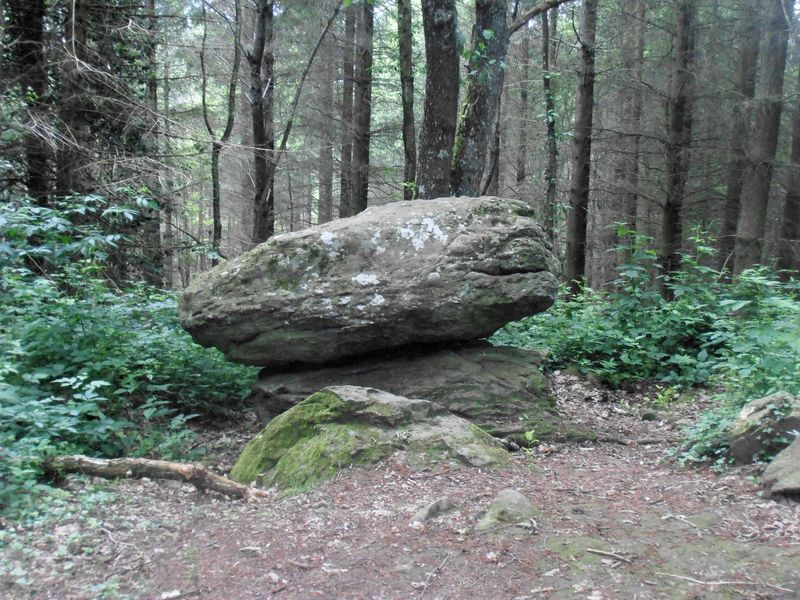
Photo credits : OT Pays des Combrailles, OT Combrailles, OT Combrailles, OT Combrailles, OT Combrailles
 Updated on 5 May 2025 by Office de Tourisme des Combrailles