![]()
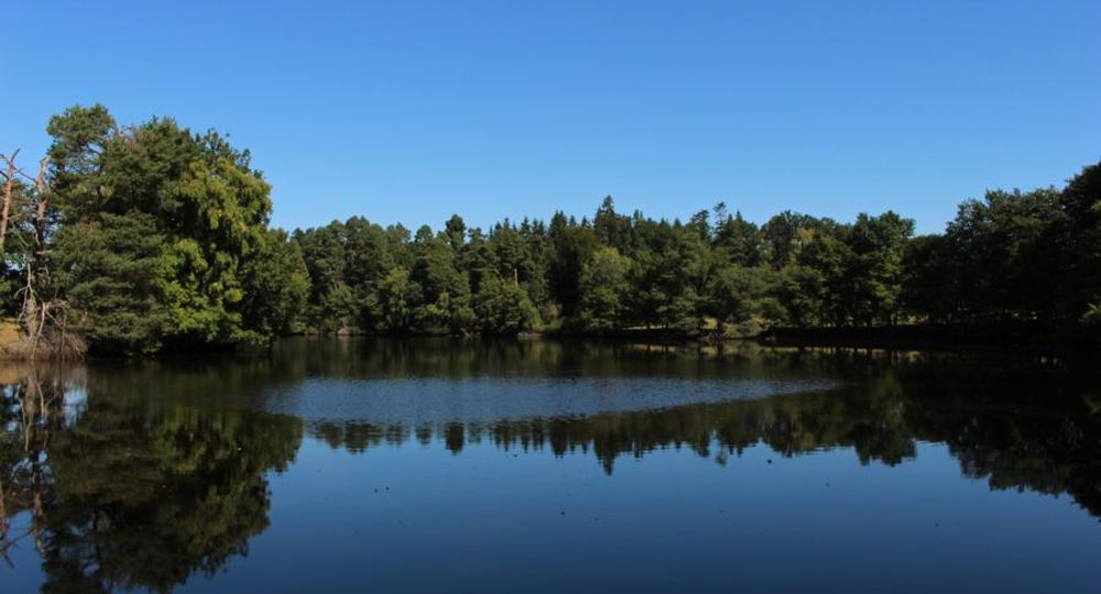
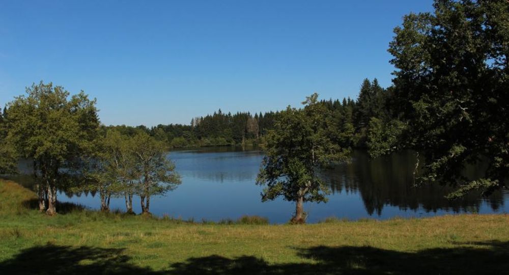
Gasserot pond
Saint-Avit-d’Auvergne
 Dogs allowed
Distance 7.5Km
Duration 2h15
Hiking route BOUCLE
Marking Yellow
In pictures
Route description
A pretty loop through a wooded landscape with fine views of the puys and the Sancy massif, which runs quietly alongside the Etang de Gasserot and leads to the Etang de Tyx (variant), renowned for its aquatic flora and fauna.
Trail highlights
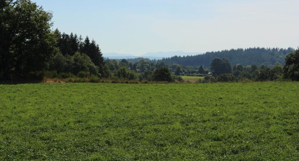
– Views of the Sancy massif and the Chaîne des Puys.
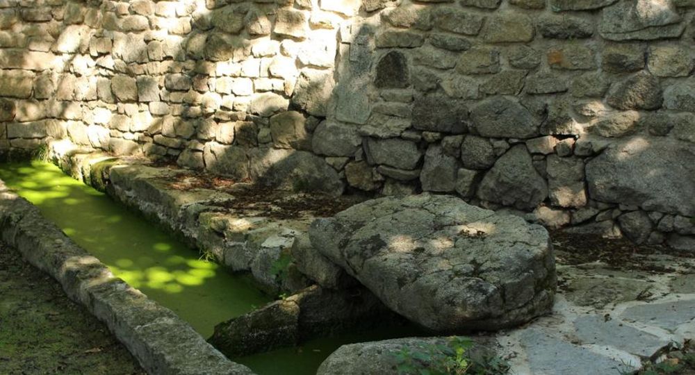
– Small heritage features : communal oven.
Guidebook with maps/step-by-step
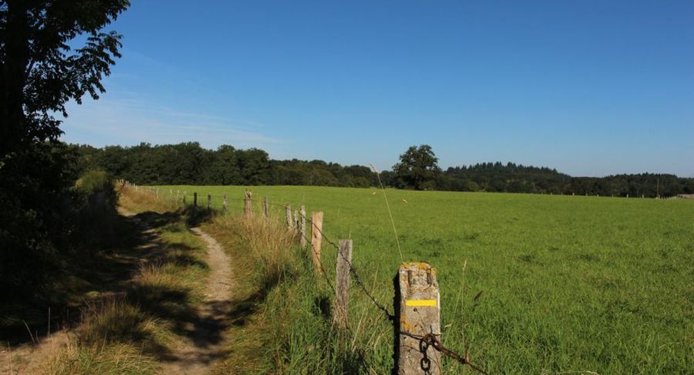
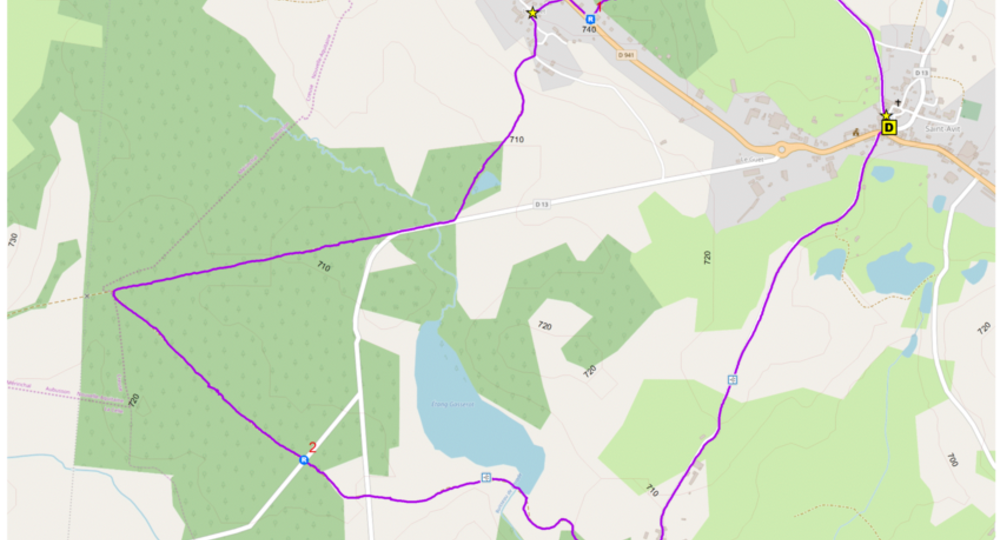
Step 1 : In the direction of the church (view of the church), take the D551. On leaving Saint-Avit, take the first track on the left. Follow it through the Bois des Chaumes. Climb up to the D941 (view of the Sancy massif).
Step 2 : Take the road to the right as far as the first houses in Le Guet. Enter the hamlet via the first street on the left. At the village center (four banal), turn left, then down the first path on the right. Follow a pond to the D13. Turn right and take the first forest track on the right. After 1 km, turn left on a gravel road to the D582.
Step 3 : Continue straight ahead. Ignore the side tracks before crossing the D13 and continue on the track opposite. Drive alongside the Gasserot pond (pond view). Turn right at the fork. After a slight climb, descend towards the village. Take the asphalt road to the left, passing through Tyx. Continue along the road (view of the Chaîne des Puys) to the starting point.
Proposed and managed by the Conseil départemental du Puy-de-Dôme – PDIPR.
/* col-6_sm-12 */ ?>
Opening hours
All year round daily.
Subject to favorable weather.
Comfort, facilities and services
- Pets welcome
Additional information
For your own safety, always take a bottle of water, a hat, warm clothing and footwear suitable for walking.
Depending on weather conditions, certain itineraries are not recommended in bad weather (fog) or are not practicable, or even forbidden, during the winter season.
Some sites are fragile, so stay on the marked trails. Avoid picking wild flowers and disturbing wildlife. Pick up your garbage.
Animals are not allowed on some routes.
Dogs allowed Dogs must be kept on a leash due to the presence of herds.
Environment
Presence of livestock and guard dogs
Access
Reach Saint-Avit on the D941 west of Clermont-Ferrand, 15 km from Pontaumur.
Parking and signpost near the church.
Downloadable :
Photo credits : OT Combrailles, OT Combrailles, OT Combrailles, OT Combrailles, OT Combrailles, Conseil départemental du Puy-de-Dôme