
La Pierre Pamole
Vollore-Montagne
 Dogs allowed
Distance 16.5Km
Duration 4h30
Hiking route BOUCLE
Marking Green
In pictures
Route description
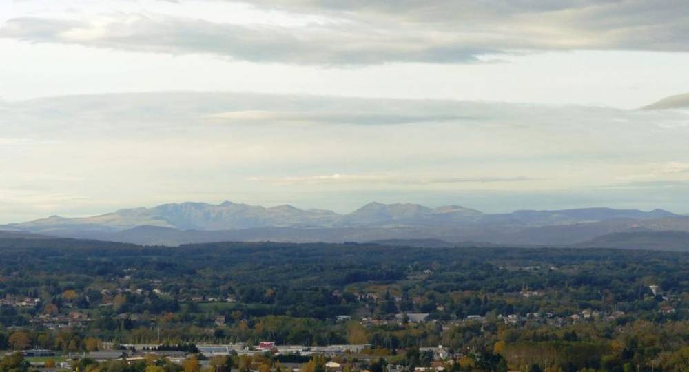
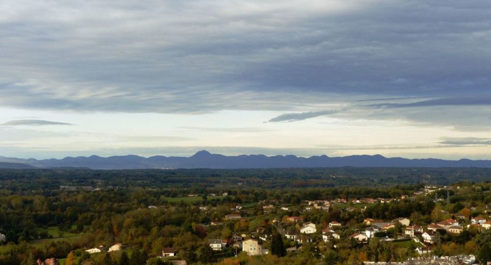
You’ll discover a very open site, where boulders stand tall, and above all, an extraordinary 360° view of all the mountains with its two orientation tables.
Trail highlights
– La Pierre Pamole.
– View over the Dore plain, Limagne, Chaîne des Puys, Sancy massif and Cantal massif.
– View of the Chignore.
– View of the volcanic hills of Billomois and Comté.
– View of the town of Arconsat.
– Panoramic view of the Monts du Lyonnais, the Alps and the Forez massif and its summit.
– View of Pierre-sur-Haute (1,634 m), highest point of the Forez mountains.
Guidebook with maps/step-by-step
Step 1 : In the village, near the restaurant, at the information sign. Take the road to the crossroads with the Viscomtat road, turn right towards Noirétable and turn left at the former Hôtel du Pont. Climb up to the road, which you cross and continue to climb (view over the Dore plain, Limagne, the volcanic hills of Comté and, in the distance, the Chaîne des Puys, the Sancy massif and the Cantal massif).
Step 2 : At the top of the hill, cross the road to continue uphill. At the next road, continue straight on towards La Chevalerie (viewpoint over the Chignore). At the last house in La Chevalerie, continue uphill to the right. At the TV relay station, continue along the track. 50 m after a loop in the track, take a small path that climbs to the right. In the clearing, take a path down to the left ; at the bottom of this path, take the track to the right.
Step 3 : At the road, turn left, then at the next crossroads, turn right twice in the direction of Mousset, pass the hamlet and continue uphill. At a large wood storage area, leave the track on the right and continue straight on. At the next crossroads, continue uphill on this wide track.
Step 4 : In a clearing (you can return to Pierre Pamole by taking the slightly uphill path on the left) : at the summit, walk around the rocky outcrop, taking in the landscape from the Cantal and Sancy to the south, the Billomois and Comté volcanic hills to the east, the Chaîne des Puys to the north, Montlune and the town of Arconsat, and to the west, the Monts du Lyonnais, the Alps and the Forez massif and its summit, Pierre-sur-Haute), take the path that descends into the woods behind the signpost indicating “Pierre Pamole”. At the next crossroads, take the path on the right (Arbre du Diable) and continue straight ahead to reach Le Pertuis.
Next step
Step 5 : Cross the D42 to go straight ahead. At the next crossroads, turn left into the hamlet of Les Rallières, which you cross. Continue along the same road. At a T-junction, turn left.
Proposed and managed by the Conseil départemental du Puy-de-Dôme – PDIPR.
Opening hours
From 01/01 to 31/12 daily.
Subject to favorable weather.
Comfort, facilities and services
- Pets welcome
Additional information
For your own safety, always take a bottle of water, a hat, warm clothing and footwear suitable for walking.
Depending on weather conditions, certain itineraries are not recommended in bad weather (fog) or are not practicable, or even forbidden, during the winter season.
Some sites are fragile, so stay on the marked trails. Avoid picking wild flowers and disturbing wildlife. Pick up your garbage.
Animals are not allowed on some routes.
Dogs allowed Dogs must be kept on a leash due to the presence of herds.
Environment
In the country, Forest location, Mountain view, Presence of livestock and guard dogs
Access
From the village of Celles-sur-Durolle, take the D7 towards Sainte-Agathe. At Col de Frisonnet, turn left onto the D102 towards Vollore-Montagne (30 mins from Thiers).
Photo credits : CD63 / C.Bachelerie, CD63 / C.Bachelerie
 Updated on 2 July 2026 by Conseil départemental du Puy-de-Dôme