
Chemin des Papetiers
Ambert
 Dogs allowed
Distance 7.5Km
Duration 2h30
Hiking route BOUCLE
Marking Yellow
In pictures


Route description
Alongside the cutlery industry in the Thiers basin, paper production in Ambert forged the Livradois-Forez region. Spinning wheels are ubiquitous, and it’s easy to imagine all the mechanisms put in place to harness the power of water.
Trail highlights
– View over the Ambert plain.
– Spinning wheels (old mills) can be seen all along the route.
– The Dore : a tributary of the Allier, the Dore rises in the Livradois at an altitude of 1,000 metres. Its valley separates the Forez mountains to the east and the Livradois mountains to the west. The river flows through a narrow passage between the Forez and Livradois mountains, then turns into a gully that accelerates its course.
– Nearby : Richard-de-Bas mill, historical paper museum from its origins and the different writing media.
Guidebook with maps/step-by-step
Step 1 : From the Valeyre crossroads, take the path up between the houses. At the square, continue straight ahead. Continue on the road opposite before taking the small road on the left towards Petit-Vimal. Cross the bridge and fork left in front of the house ; go around it to take the grassy path on the right that climbs up. At the crossroads, turn right. At the road, turn right.
Step 2 : At the entrance to Nouara, take the road to the left to cross the footbridge. Pass between the houses. At the porch, turn left onto the grassy path. Cross the stone bridge and climb the path. Climb the stairs and turn right onto the path. Cross the footbridge and continue on the opposite bank. Continue on the main path.
Step 3 : Take the path that rises to the right. At the top, go down the path opposite (view of the Ambert plain). At the crossroads, turn left and continue straight ahead to the village of La Combe, then cross the road. Pass the 2 houses of Richard-de-Haut. At the isolated house, take the grassy path on the left. At the crow’s-foot, turn right down the grassy path.
Step 4 : Go straight through the hamlet of Grivel. At the road, turn right, then right again. At a hairpin bend, turn right. Just before the main road, follow the road to the right as far as Longechaud. Cross the main road. Opposite a house, turn left onto a grassy path. At the “patte d’oie” (crow’s-foot), turn right onto the main path, which leads downhill to the footbridge.
Next step
Step 5 : Turn right. At the end of the path, turn left and cross the esplanade. Continue straight ahead until you reach the D357. Follow the road to the left for 650 m. At Ribeyre, take a path on the right. At the top, turn left onto the path. At the crow’s-foot, continue downhill. Cross the road. Instead, take the same path as before and return to the starting point.
Proposed and managed by the Conseil départemental du Puy-de-Dôme – PDIPR.
Opening hours
From 01/01 to 31/12 daily.
Subject to favorable weather.
Comfort, facilities and services
- Pets welcome
Additional information
For your own safety, always take a bottle of water, a hat, warm clothing and footwear suitable for walking.
Depending on weather conditions, certain itineraries are not recommended in bad weather (fog) or are not practicable, or even forbidden, during the winter season.
Some sites are fragile, so stay on the marked trails. Avoid picking wild flowers and disturbing wildlife. Pick up your garbage.
Animals are not allowed on some routes.
Dogs allowed Dogs must be kept on a leash due to the presence of herds.
Environment
Mountain view, Presence of livestock and guard dogs
Access
From the town of Ambert, take the D996 towards Montbrison. On leaving Ambert, follow the D57 towards Moulin Richard de Bas. Continue for 1.5 km and park in the village of Valeyre.
You might also like…
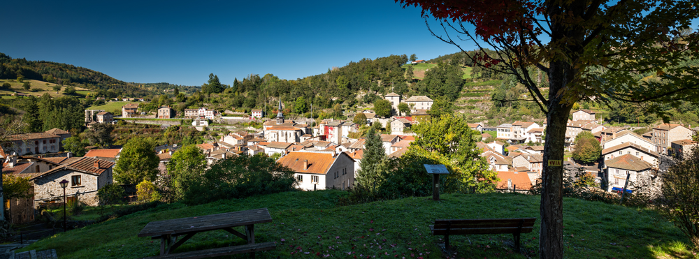
Photo credits :
 Updated on 3 July 2026 by Conseil départemental du Puy-de-Dôme