
Le Grün de Chignore
Vollore-Ville
 Dogs allowed
Distance 16Km
Duration 5h30
Hiking route BOUCLE
Marking Green
In pictures
Route description
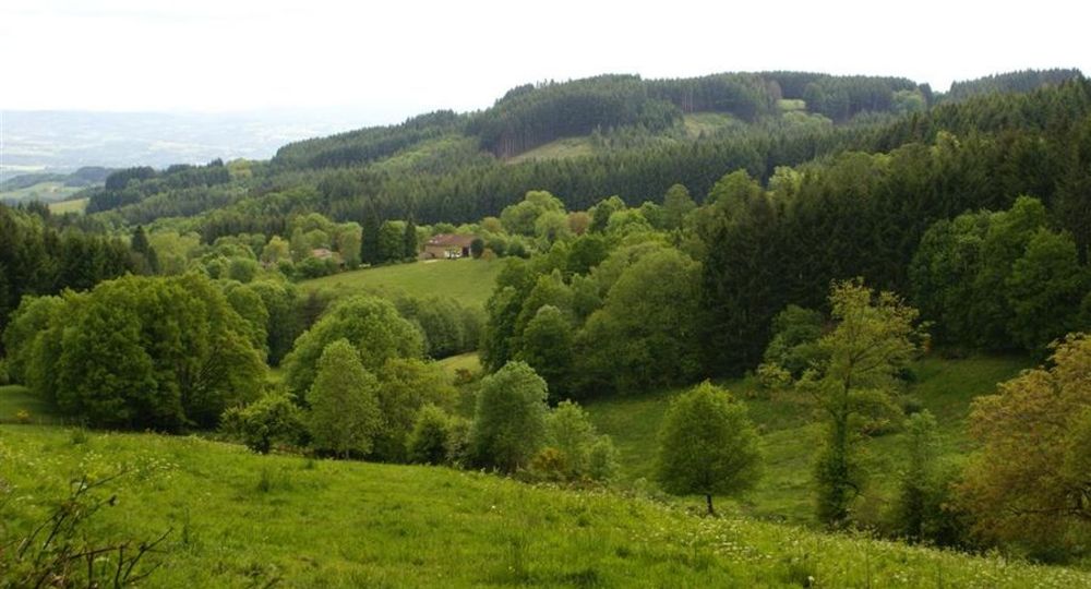
In the Forez region, the Grün de Chignore mountain is dominated by the Pic de Chignore (1,074 m), from which you can see the Limagne plain and the volcanoes of the Monts Dôme and Monts Dore. Woodland crossings and open paths punctuate the hike.
Trail highlights
– View of the Grün de Chignore, the Limagne plain, the Chaîne des Puys, the Sancy massif, the Bois-Noirs, the Forez, Dôme and Dore mountains.
Guidebook with maps/step-by-step
Step 1 : From the Vollore-Ville campsite, 1 km from town, towards Sainte-Agathe. Take the path alongside the campsite down to the lake ; follow it for 400 m. Turn left towards Chossière. In Chossière, follow the wash-house to the left, then turn right up the road. Leave the road at the bend and follow the track opposite. At the intersection, turn left towards the spring.
Step 2 : Cross the Chaize-Haute (view of the Grün de Chignore) and take a path through the woods. Climb up the paved path, crossing a stream at the top. At the next two crossroads, continue straight ahead, then turn right towards Rochemulet (view of the Limagne plain, the Chaîne des Puys and the Sancy massif). Take the road to the left, then the first track to the right.
Step 3 : After 100 m, turn left up a faint path through the woods. At the rocky chaos, follow the path into the moorland. You’ll find a more marked path, which you leave on a flat area to climb to the right across the moor. At the top of the hill, follow the wood to the right (view of the Bois-Noirs). 20 m further on, descend into this wood and join a forest track. Follow it to the left, ignoring the other tracks. At the end of the forest, turn right down the forest road (view of Monts du Forez).
Step 4 : At the crossroads, take the left-hand track (private property). At the Chouvel ruins, turn right. At the crow’s-foot, keep left. Take the path to the right of the Maison forestière du Naud and continue straight ahead. At the Maison forestière d’Ayguebonne, take the path on the left. At the crossroads, follow the flat track to the left (view of Limagne, Monts Dôme and Monts Dore). After the scree, at a platform, take the path on the right through the woods. At the intersection, continue between 2 low walls. After approx. 300 m, turn right.
Next step
Step 5 : At Lacoux, turn right along a meadow. At the first Châtelet ruins, turn left, then immediately right. At Fargevieille, take the track on the right. 200 m further on, turn left down the track. Cross the D312. The track opposite joins the starting point.
Proposed and managed by the Conseil départemental du Puy-de-Dôme – PDIPR.
Opening hours
From 01/01 to 31/12 daily.
Subject to favorable weather.
Comfort, facilities and services
- Pets welcome
Additional information
For your own safety, always take a bottle of water, a hat, warm clothing and footwear suitable for walking.
Depending on weather conditions, certain itineraries are not recommended in bad weather (fog) or are not practicable, or even forbidden, during the winter season.
Some sites are fragile, so stay on the marked trails. Avoid picking wild flowers and disturbing wildlife. Pick up your garbage.
Animals are not allowed on some routes.
Dogs allowed Dogs must be kept on a leash due to the presence of herds.
Environment
Forest location, Mountain view, Presence of livestock and guard dogs
Access
From Courpière, take the D7 towards Vollore-Ville. The campsite is located on the outskirts of the village, in the direction of Vollore-Montagne.
Photo credits :
 Updated on 2 July 2026 by Conseil départemental du Puy-de-Dôme