
The Virgin’s bed
Vollore-Montagne
 Dogs allowed
Distance 11Km
Duration 3h30
Hiking route BOUCLE
Marking Yellow
In pictures


Route description
A hike along the ancient medieval border between the Puy-de-Dôme and the Loire, marked by royal milestones. The woods lead to a rocky chaos known as the “Lit de La Vierge”.
Trail highlights
Views of the Alps, Forez and Chaîne des Puys.
Guidebook with maps/step-by-step
Step 1 : From the village of Rossias, take the path up to the left of a wooden shed. At the T-junction, turn right to join the asphalt road. At the minor road, turn right. At the crow’s-foot, continue on the same road, slightly to the left. About 400 m further on, leave the road leading down to Les Grangettes and continue on the same road.
Step 2 : 500 m further on, follow the road which rises sharply to the left towards a forest house ; go alongside it and continue on this small road which soon becomes a footpath. At the crossroads, continue straight ahead on the forest track. At a bend in the D42, take the gravel path on the left. This becomes a forest track, which we continue to follow. At the crossroads of four paths, go straight ahead.
Step 3 : At the end of the climb, leave the wide track on a flat area and take a small path to the right. 150 m further on, turn left at a concrete marker. You then follow a ditch that separates the departments of Puy-de-Dôme and Loire (a very old boundary that takes up a medieval border marked by armorial posts).
Step 4 : Leaving the ditch, turn left to reach the rocky Chaos at the top of which is the bed of the Virgin (possibility of access to the summit : caution, slippery rocks) ; (view of the Alps, Monts du Forez, Chaîne des Puys). At the foot of the chaos, take a path to the right and continue until you reach a clearing (Saint-Guillaume cross) from which several paths lead off.
Next step
Step 5 : Take the left-hand track downhill (caution : do not take the left-hand track just before the clearing). At the crossroads, continue on the same track. At the next crossroads, turn left as far as the Sagne houses, then left. At the crossroads, turn right, then take the first path up to the right, and finally a small path down to the right of the road. The road becomes a path and leads back down to the village of Rossias.
Proposed and managed by the Conseil départemental du Puy-de-Dôme – PDIPR.
Opening hours
From 01/01 to 31/12 daily.
Subject to favorable weather.
Comfort, facilities and services
- Pets welcome
Additional information
For your own safety, always take a bottle of water, a hat, warm clothing and footwear suitable for walking.
Depending on weather conditions, certain itineraries are not recommended in bad weather (fog) or are not practicable, or even forbidden, during the winter season.
Some sites are fragile, so stay on the marked trails. Avoid picking wild flowers and disturbing wildlife. Pick up your garbage.
Animals are not allowed on some routes.
Dogs allowed Dogs must be kept on a leash due to the presence of herds.
Environment
In the country, Forest location, Mountain view, Presence of livestock and guard dogs
Access
From the village of Celles-sur-Durolle, take the D7 towards Sainte-Agathe. At Col de Frisonnet, turn left onto the D102 towards Vollore-Montagne.
In Vollore-Montagne, take the D42 towards Augerolles. At the end of the village of Vollore-Montagne, turn left onto the D102 towards La Renaudie. After 2 km, park in the village of Rossias.
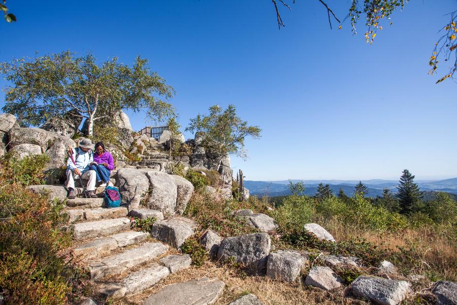
Photo credits : Conseil départemental du Puy-de-Dôme, Conseil départemental du Puy-de-Dôme, Conseil départemental du Puy-de-Dôme
 Updated on 2 July 2026 by Conseil départemental du Puy-de-Dôme