
The Puy of Lavelle
Saint-Vincent
 Dogs allowed
Distance 10.5Km
Duration 3h00
Hiking route BOUCLE
Marking Yellow
In pictures
Route description
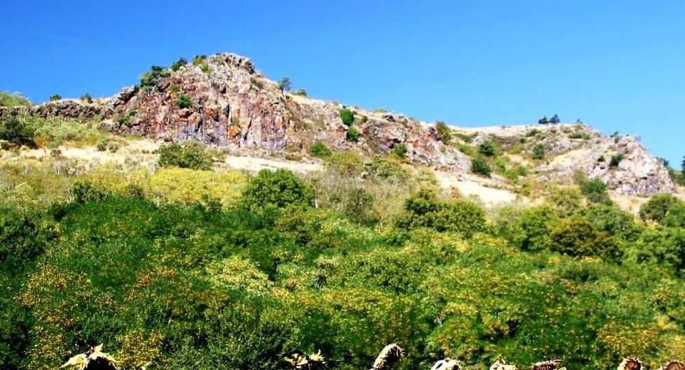
From Saint-Vincent you can walk along the rather arid hills characteristic of the south of the Puy-de-Dôme. We climb to the top of the puy of Lavelle with a beautiful view of Issoire, the Lembron and the Sancy massif. A hike appreciated for its panoramic views.
Starting point – Follow the street towards the D26, then take the first street on the right. Walk along the cemetery, then the stadium. Turn left to take a street parallel to the D26 for 100 m. To cross it. Follow the D629 in front for 100 m then turn(…)
Trail highlights
– View of Clémensat, the church of Saint-Floret and the Dore mountains.
– View of the villages of Lavelle and Saint-Vincent.
Guidebook with maps/step-by-step
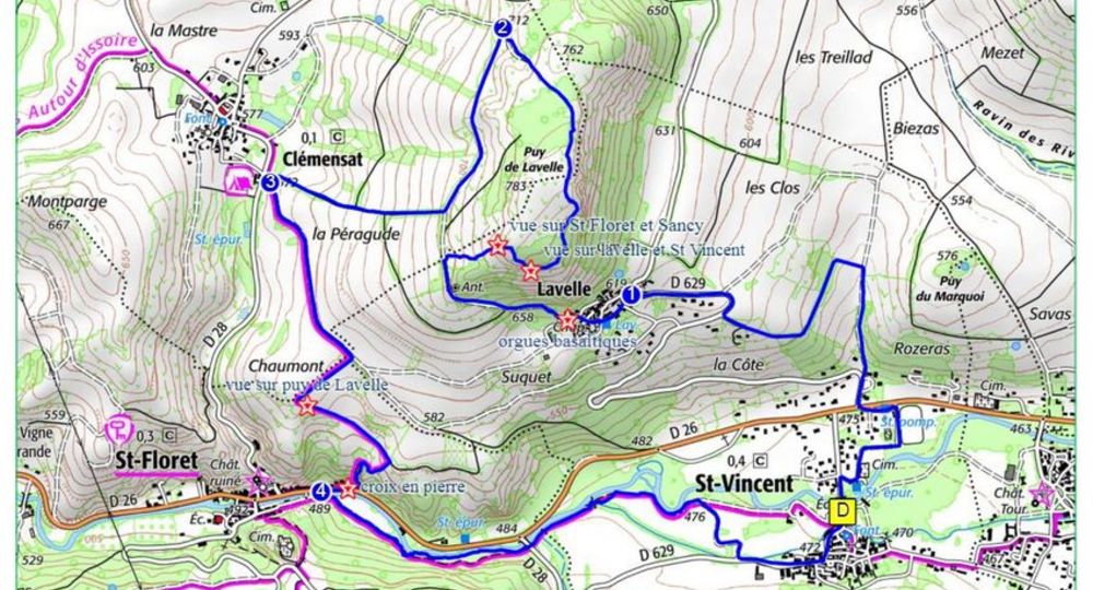
Step 1 : Follow the road towards the D26, then take the first turning on the right. Go past the cemetery, then the stadium. Turn left to take a street parallel to the D76 for 100 m. Cross the road. Follow the D629 opposite for 100 m, then turn right onto a tarmac road. Continue uphill to the first intersection, then turn left. Ignore two left-hand paths. Continue until you reach the D629. Turn right as far as Lavelle.
Step 2 : Turn left into rue de La Ribe. Pass the church and turn left into rue de La Chapelle. Continue along rue du Suquet. At the end of the village, turn right onto orgues basaltiques. At the next two intersections, take the right-hand path. After two wooden benches, turn right to follow a track that climbs the moor between junipers. Follow the track up to the right (view of Clémensat, the church of St Floret and the Monts Dore range), around the rocky summit on the edge of a cliff (view of Lavelle and St Vincent). Continue uphill to a wide track. Turn right and descend to a crossroads.
Step 3 : Turn left. At the fork, go right to the entrance to Clémensat.
Step 4 : At the T junction, turn left. At the next intersection, turn right. At the next crossroads, continue downhill to the left (view of Puy de Lavelle). Turn right onto a small path that quickly descends into a ravine and joins the D26 at St Floret (stone cross). Cross the road and turn right to reach a footbridge.
Next step
Step 5 : Cross the bridge, fork left along the Couze Pavin, cross the D28, pass over a lock, continue along a path and then a track. Continue right to the road. Turn left towards the church, cross the bridge over a branch of the Couze and, leaving the streets to the right, return to the starting point.
Proposed and managed by the Conseil départemental du Puy-de-Dôme – PDIPR.
Opening hours
From 01/01 to 31/12 daily.
Subject to favorable weather.
Comfort, facilities and services
- Pets welcome
Additional information
For your own safety, always take a bottle of water, a hat, warm clothing and footwear suitable for walking.
Depending on weather conditions, certain itineraries are not recommended in bad weather (fog) or are not practicable, or even forbidden, during the winter season.
Some sites are fragile, so stay on the marked trails. Avoid picking wild flowers and disturbing wildlife. Pick up your garbage.
Animals are not allowed on some routes.
Dogs allowed Dogs must be kept on a leash due to the presence of herds.
Environment
In the country, Mountain view, Presence of livestock and guard dogs
Access
From Issoire, take the D996 towards Champeix. At Perrier, turn left onto the D26 for 4 km, then left again to reach St Vincent. Departure sign in the parking lot opposite the town hall.
Downloadable :
Photo credits : N. Dutranoy, Pays d’Issoire, CC Puys et Couzes, CC Puys et Couzes, Conseil départemental du Puy-de-Dôme
 Updated on 29 May 2026 by Conseil départemental du Puy-de-Dôme