![]()
Puy de Montrodeix
Orcines
 Dogs allowed
Distance 14Km
Duration 4h15
Hiking route BOUCLE
Marking Green
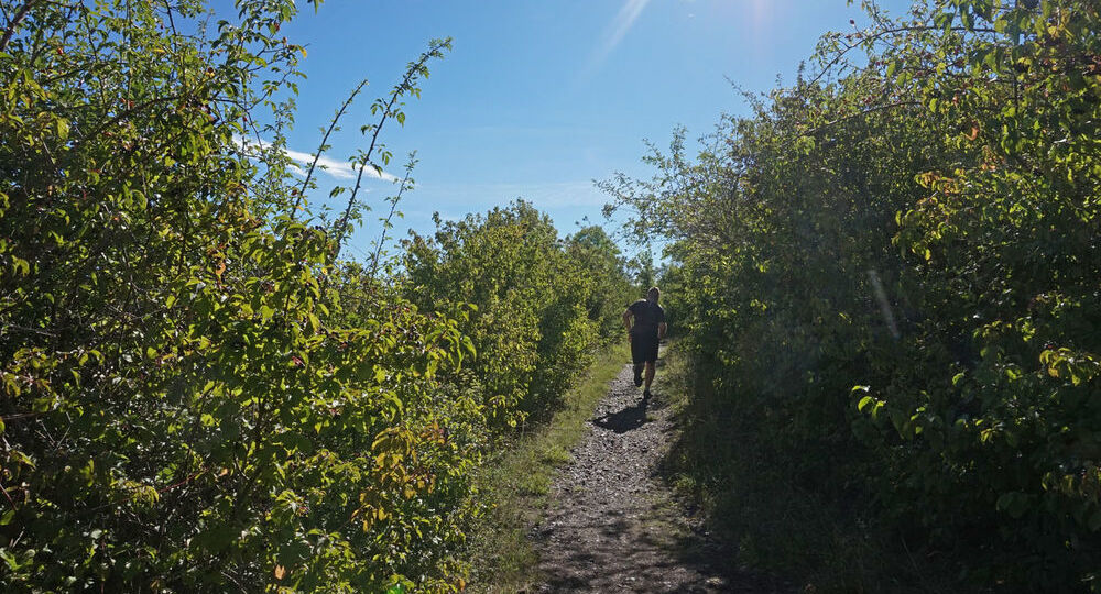
In pictures
Route description
This trail on the edge of the Dômes plateau offers a wealth of attractions, including a built heritage of fountains, washhouses, crosses, a Romanesque church, caves (des Laveuses and du Chien), the Villars menhir, ancient paths and basalt organs.
Trail highlights
– Roman road.
– Villars fountain, washhouse and Christianized menhir.
– View of Puy de Dôme, Tiretaine valley.
– Fontanas : reach, fountains, vaulted stables.
– Château de Montrodeix ruins and basalt organs.
– Calvary of Plantas.
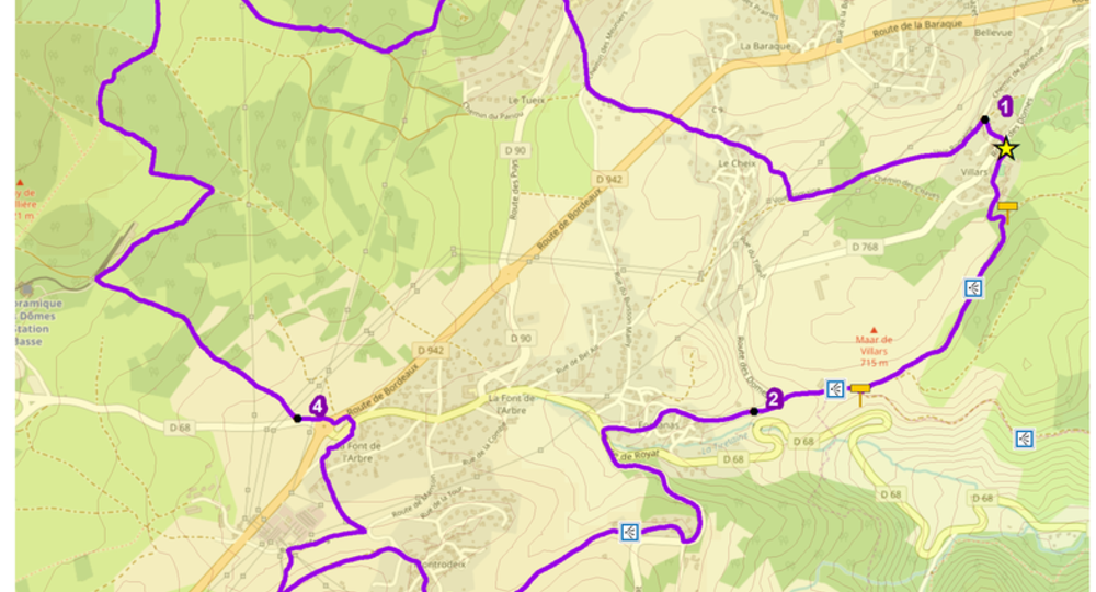
Guidebook with maps/step-by-step
Step 1 : In Orcines, the start sign is in the church parking lot.
From the starting point, walk down Rue de la Mairie, then turn right on the road for 40 m. Turn left downhill to a crossroads, then take the second small road on the left to the D942. Cross it towards Le Cheix. At the wash-house, turn right down the road, then straight ahead on a track. At the second crossroads, turn left (Roman road) and follow it to the asphalt road.
Step 2 : Turn right. Cross the D768 and pass the fountain-lavatory and the Christianized Villars menhir. Continue through the hamlet and, 150 m further on, turn right onto the plateau (view of Puy de Dôme). At the T junction, turn right (overlooking the Tiretaine valley) and join the D768.
Step 3 : Go through Fontanas (off the route : 100 m along rue de la Cascade, with its millstream, fountains and vaulted stables). At the D68/D768 junction, turn left (dangerous traffic). 100 m further down, take the D90 up to Château de Solagnat, then turn right into Rue de Missole and continue along Chemin de Montrodeix (view of the Puy de Dôme and Puys) to the road.
Step 4 : Cross the road and, via rue de Sagne-Vida, reach the Montrodeix village square (fountain). After the bus shelter, turn left onto chemin du Château-fort. At the crossroads, climb left to the puy de Montrodeix (basaltic organs – 15 min.). Back at the crossroads, take the track opposite down to the road. Turn right and, at the first crossroads, take the “chemin des Rouges gorges” to the left as far as the large road junction. To cross this dangerous junction, shortly after the “La Font de l’Arbre” sign, cross the D68 to join the path leading to a crosswalk over the D942. Follow the Puy de Dôme road to the first path on the right.
Next step
Step 5 : Take this path for about 1 km. Below the Panoramique des Dômes garage, take the first track on the right and follow it to an intersection. Climb left along the pasture (facing the Puy de Dôme) until you reach the chicane, then turn right onto the path winding through birch and fir trees. At the golf course, go straight ahead for 350 m until you reach a track on the right.
Step 6 : Take this track and follow it down to the first crossroads. Go straight ahead and, after 200 m, turn left onto a path bordering a pine forest and passing under a power line. At the end of the path, turn right, passing a drinking trough. At the road, turn right to return to the starting point.
Proposed and managed by the Conseil départemental du Puy-de-Dôme – PDIPR.
/* col-6_sm-12 */ ?>
Opening hours
From 01/01 to 31/12 daily.
Subject to favorable weather.
Comfort, facilities and services
- Pets welcome
Additional information
For your own safety, always take a bottle of water, a hat, warm clothing and footwear suitable for walking.
Depending on weather conditions, certain itineraries are not recommended in bad weather (fog) or are not practicable, or even forbidden, during the winter season.
Some sites are fragile, so stay on the marked trails. Avoid picking wild flowers and disturbing wildlife. Pick up your garbage.
Animals are not allowed on some routes.
Dogs allowed All dogs must be kept on leashes because of the presence of herds.
Environment
In the country, Presence of livestock and guard dogs
Access
At La Baraque, in the commune of Orcines on the D941 (coming from Clermont). At the traffic lights, turn right towards Pontgibaud, Limoges. At the next set of traffic lights, turn left towards the church parking lot.
Downloadable :
Photo credits : ESM-CAT, Conseil départemental du Puy-de-Dôme