![]()
The three steeples trail
Prompsat
 Dogs allowed
Distance 7.5Km
Duration 2h00
Hiking route BOUCLE
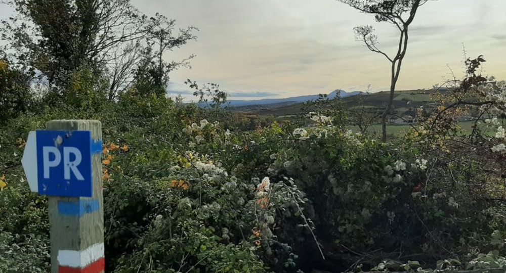
Marking Blue
In pictures
Route description
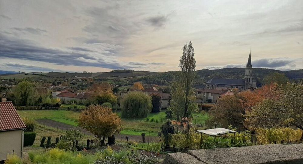
This walk takes you through Prompsat, Teilhède and Gimeaux, three typical Combrailles villages surrounded by cereal crops and vineyards. There are fine views over the Limagne plain.
Trail highlights
– Former property of Etienne Clémentel.
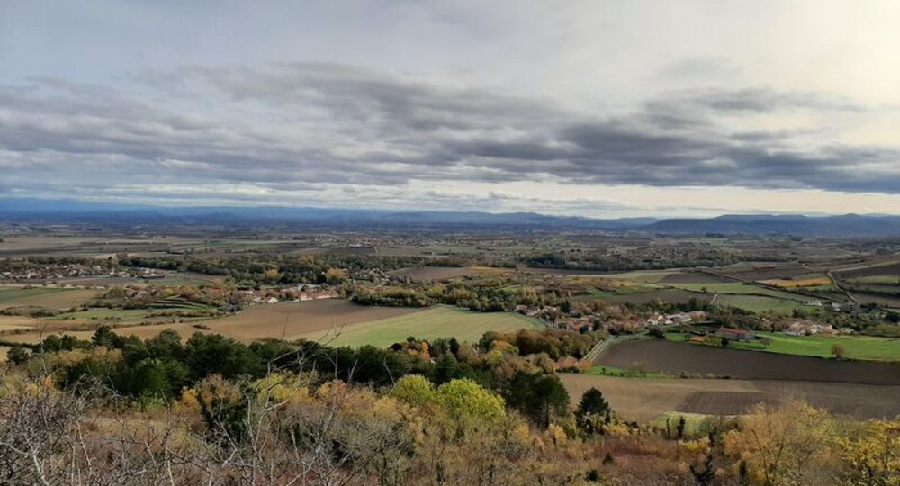
– Panoramic views over Limagne, Forez, the Gergovie plateau and the Chaîne des Puys.
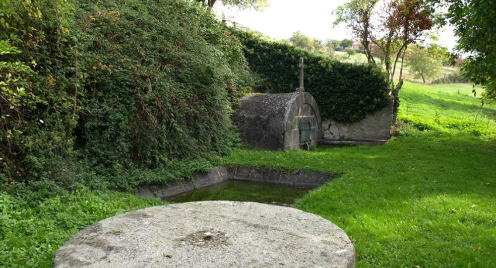
– Petrifying springs.
Guidebook with maps/step-by-step
Step 1 : From the start sign, climb rue E.Clémentel. Turn left into rue de la Fontaine Daupary and, 150 m further on, fork right into rue du Quéreux (Etienne Clémentel’s former property). At the stop sign, turn right as far as the fountain.
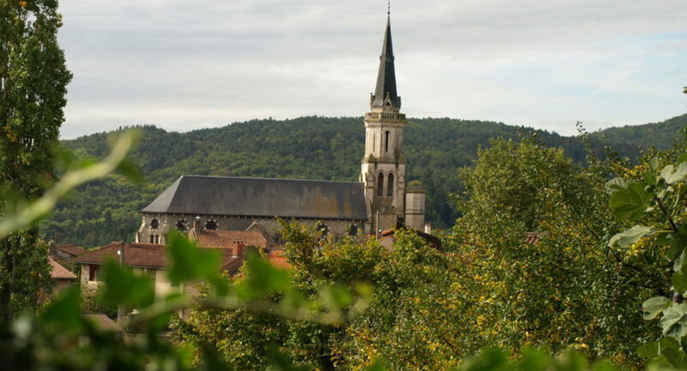
Step 2 : Turn left, go straight ahead at the next two crossroads and take the first path on the right down to the bottom of the valley. Cross the Fourneaux stream over the small bridge to Teilhède. At the entrance to the village, turn right and then left at a cross. Walk past the church porch to the center of the square (monumental carved cross).
Step 3 : Opposite the churchyard, cross the D17 and go up the impasse St-Pierre. At the fork, turn left, passing over the fountain topped by a cross, then over the wash-house. Fork left, then immediately right to join the D412 and arrive at a small square.
Step 4 : Turn right into rue du Puy de Montaury, then right into chemin des Vignes. Follow the houses along a narrow path that leads to rue du Puits, opening onto rue des Nautes. Turn right and pass the enclosure of a salt-curing company on the hillside (panoramic view of Limagne, Forez, the Gergovie plateau and the Chaîne des Puys). From the summit of Puy de Montaury, descend to the T-junction. Turn right and continue straight on to a second T-junction. Turn right to reach a third T-junction.
Next step
Step 5 : Turn right for 100 m. Leave the track and turn left to reach the crossroads 15 m further on. Go straight ahead. As you go downhill, take the second track on the left. At the intersection (La source du Ceix), turn right and go straight on to the village. At the five-way intersection (Place du Tarra), take the second street on the right (rue du Général Desaix). At the next crossroads, continue along rue du Bon Accueil. At the T-junction, turn left. At the church, turn right onto the D17. Go downhill (petrifying springs) to reach the old communal weighbridge.
Step 6 : Take rue St-Nicolas and turn right immediately onto rue du Puy. Cross a bridge and go straight up a path lined with cellars. After the last house, go straight on to a vineyard hut. Turn right towards Prompsat. Stay on the main road. At the crossroads, go straight ahead. At the bottom of rue du Pré Lacos, turn right and continue left to rue du Tronçon. Continue straight ahead. At the second crossroads, turn right into rue du Peyrou and join rue E.Clémentel. Walk down this street to reach the starting point.
Proposed and managed by the Conseil départemental du Puy-de-Dôme – PDIPR.
/* col-6_sm-12 */ ?>
Opening hours
All year round daily.
Subject to favorable weather.
Comfort, facilities and services
- Pets welcome
Additional information
For your own safety, always take a bottle of water, a hat, warm clothing and footwear suitable for walking.
Depending on weather conditions, certain itineraries are not recommended in bad weather (fog) or are not practicable, or even forbidden, during the winter season.
Some sites are fragile, so stay on the marked trails. Avoid picking wild flowers and disturbing wildlife. Pick up your garbage.
Animals are not allowed on some routes.
Dogs allowed Dogs must be kept on a lead due to the presence of herds.
Environment
In the country, Presence of livestock and guard dogs
Access
North of Clermont-Ferrand, from Riom, head towards Châtel-Guyon. On entering the town, at the roundabout, take the D227, then turn right onto the D411 to reach Prompsat. The starting sign is adjacent to the Rue E. Clémentel and the Place du 8 Mai 1945 (car park) in the town.
Downloadable :
Photo credits : Office de Tourisme des Combrailles, Office de Tourisme des Combrailles, Office de Tourisme des Combrailles, Conseil départemental du Puy-de-Dôme, Conseil départemental du Puy-de-Dôme