
The Chauriat hillsides
Chauriat
 Dogs allowed
Distance 9.7Km
Duration 3h00
Hiking route BOUCLE
Marking Yellow
In pictures
Route description
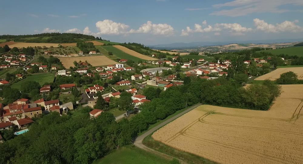
The environment of Chauriat, a former village fort, is typical of the Limagne region : garlic and cereal crops and hillsides with good exposure for vines.
Trail highlights
– View of Chauriat, Château de Bard, Petit Turluron.
– Maison Rudel.
– Panorama from the Dômes range to the Sancy.
– View from puy Saint Romain to Forez.
– View from Forez to Beauregard-l’Evêque.
Guidebook with maps/step-by-step
Step 1 : From the start sign in the parking lot, take the Chemin des Mûres around the tennis court. At the first fork, turn right. At the crossroads (two-sided stone cross), go straight on, ignoring the side paths (view of Chauriat, Château de Bard, Petit Turluron). Continue straight ahead until you pass an enclosed property planted with pine trees.
Step 2 : Immediately after the property, turn left at right-angles. At the T-junction, keep left until you enter Chauriat. Go straight ahead, past the Mission cross (Place Pasteur), cross Boulevard de la République and go up Rue des Banches to the Mairie. Turn right on Rue des Cuvages and immediately left on Espace Antoine Rudel du Miral as far as Place Lafayette (Maison Rudel [town hall], church, housing). Turn right down rue du Commerce. Cross Boulevard Marx Dormoy. Head up Rue des Plantades, then the Chemin de Bard, which continues it, as far as a stone cross.
Step 3 : After the cross, turn left and continue along a long hillside path (panoramic view from the Dômes range to the Sancy) to an intersection. Climb left towards Puy Benoît to a crow’s-foot.
Step 4 : Keep going straight up (an alternative route is via the passageway over Puy Benoît, if open). At the high point of the path (view from Puy Saint Romain to Forez), start a gentle descent down the hillside to the first crossroads with a view of Chauriat.
Next step
Step 5 : Turn right at right-angles, then left to reach the road. Cross the road and immediately turn right. Continue straight on up the hillside. At the fork, continue right, still on the hillside. At the iron cross, turn left. Pass the Pileyre farm and continue until you come to a crossroads with another PR.
Step 6 : Continue level, including the first vineyards (view from Forez to Beauregard-l’Evêque). Before descending to Vertaizon, fork left onto the path leading to the summit of Puy de Pileyre (panoramic view of the surrounding puys and the highest point in Forez, Pierre-sur-Haute (1634 m)). Then descend on a path zigzagging through volcanic rock piles. When you reach a track, follow it to the left to reach an intersection.
Step 7 : At the T junction, climb left, then after 50 m, turn right onto a grassy path (along the way, views from Chauriat to the Sancy). At the first crossroads, turn right down to Chemin des Chausses. Turn right onto Chemin de Servignat. Take the first path on the left down to the starting point.
Proposed and managed by the Conseil départemental du Puy-de-Dôme – PDIPR.
Opening hours
From 01/01 to 31/12 daily.
Subject to favorable weather.
Comfort, facilities and services
- Pets welcome
Additional information
For your own safety, always take a bottle of water, a hat, warm clothing and footwear suitable for walking.
Depending on weather conditions, certain itineraries are not recommended in bad weather (fog) or are not practicable, or even forbidden, during the winter season.
Some sites are fragile, so stay on the marked trails. Avoid picking wild flowers and disturbing wildlife. Pick up your garbage.
Animals are not allowed on some routes.
Dogs allowed Dogs must be kept on a leash due to the presence of herds.
Environment
In the country, Mountain view, Presence of livestock and guard dogs
Access
From Vertaizon (20 km east of Clermont-Ferrand), take the D4 to Chauriat. Parking lot on the right at the entrance to the village, near the sports ground, before the cemetery.
Photo credits : Webcastor_capture
 Updated on 29 May 2026 by Conseil départemental du Puy-de-Dôme