![]()
The Sioule gorges
Saint-Gervais-d’Auvergne
 Dogs allowed
Distance 20Km
Duration 6h00
Hiking route BOUCLE
Marking Green
In pictures
Route description
In a sumptuous setting, dominated on one side by the imposing Château de Chouvigny and on the other by the ghostly Château Rocher, you’ll discover a route that’s well worth a visit for its fishing and tourist attractions.
Trail highlights
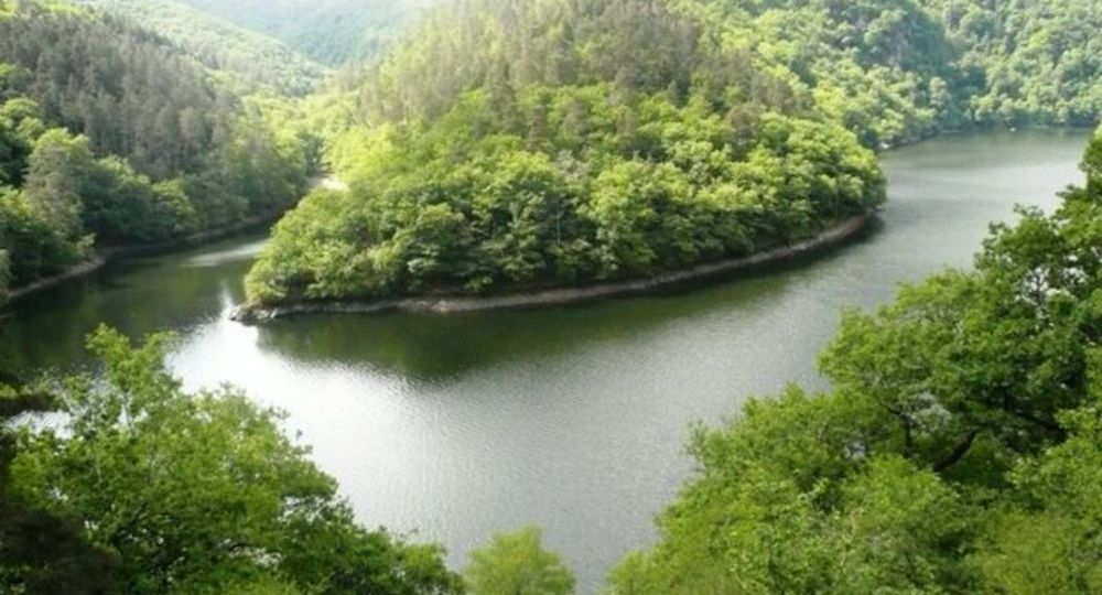
– The Queuille meander.
– A forest of oaks.
– Ruins and farm of Murat.
– The Sioule river and dam.
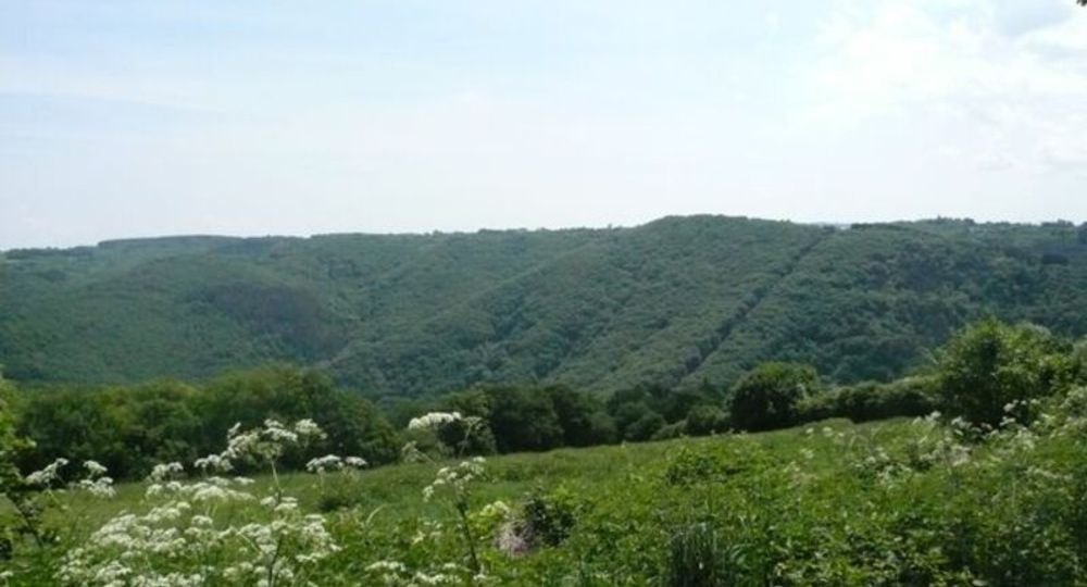
– The Cube valley.
– The bell tower of Saint-Gervais.
– The Combrailles plateau.
Guidebook with maps/step-by-step
Step 1 : From the esplanade at Le Prat, drive through the hamlet, then turn left at the crossroads. Once on the road, turn right as far as the fountain and wash-house in Le Bouchet.
Step 2 : Turn left downhill towards the Queuille dam and take the first track on the right. At the hairpin bend, take the small path opposite, descending steeply through a beautiful oak forest to the crossroads (not very visible).
Step 3 : Leave the path on the left and head downhill (ruins of the Murat farm) to the banks of the Sioule at the heart of the Queuille meander. Return to the crossroads, then take the path to the right through the forest (a well-built path that follows the Sioule and overlooks the Queuille dam) to the road.
Step 4 : Turn right. At the Queuille dam, take a path to the left above the building. Continue on this path to the hamlet of Bas-de-Lacot. Follow this path to the right under the foliage to reach the Chambon bridge.
Next step
Step 5 : Turn right, cross the bridge and turn left onto the D237 ; 100 m after the disused factory, turn left onto a grassy track. After the first houses, continue left along the Sioule. At the large pine trees, turn right to reach the road and follow it to the left. At the footbridge, cross the Sioule and turn right. In the village, at the end of the square (note : another green PR), turn left and climb up to the road. Cross the road and go straight ahead on a track that climbs rapidly through undergrowth to Grandval.
Step 6 : Take the tarmac track on the left (view of the Cube valley, the Saint-Gervais bell tower and the Combrailles plateau). At the road, continue to the right, then turn onto the first track on the right. After 1 km, at the end of a bend in the road, fork right onto the wide track until you reach the small road on the left. Cross another small road and take the track opposite. At the crossroads, cross the D531 and continue straight on to reach Le Prat.
Proposed and managed by the Conseil départemental du Puy-de-Dôme – PDIPR.
/* col-6_sm-12 */ ?>
Opening hours
All year round daily.
Subject to favorable weather.
Comfort, facilities and services
- Pets welcome
Additional information
For your own safety, always take a bottle of water, a hat, warm clothing and footwear suitable for walking.
Depending on weather conditions, certain itineraries are not recommended in bad weather (fog) or are not practicable, or even forbidden, during the winter season.
Some sites are fragile, so stay on the marked trails. Avoid picking wild flowers and disturbing wildlife. Pick up your garbage.
Animals are not allowed on some routes.
Dogs allowed Dogs must be kept on a lead due to the presence of herds.
Environment
In the country, Forest location, Presence of livestock and guard dogs
Access
From Riom, take the D227 towards Manzat as far as the entrance to Saint-Gervais-d’Auvergne, then take the D531 (truck diversions) towards Le Bouchet for 3 km and turn right towards Le Prat.
Downloadable :
Photo credits : OTC, OTC