![]()
Servant
Menat
 Dogs allowed
Distance 17.5Km
Duration 5h15
Hiking route BOUCLE
Marking grenn
In pictures
Route description
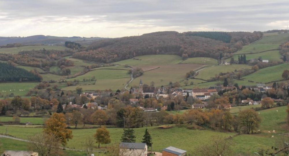
A very hilly route that passes through pastures and forests overlooking the Menat valley, with views of the Chaîne des Puys, the Sioule and Château-Rocher. The Servant lake completes the roads.
Trail highlights
– Views of the Combrailles, the Chaîne des Puys and Menat.
– Wooden and iron crosses.
– Menat Abbey : Cluniac site, Romanesque church and cloisters.
Guidebook with maps/step-by-step
Step 1 : Go down the lane to the left of the post office, which bends to the right and then to the left. After the pond, go up and at the fork, turn right towards Les Paillers. Cross the hamlet and, at the exit, take the tarmac road opposite. After 500 m, turn right at the fork, then straight ahead through the Bois de la Faye to the D2144. Cross the road and continue on the track opposite, between the guardrails. At the T-junction, turn left through the village of Les Querriaux to the end of the climb.
Step 2 : Take the tarmac track to the right. At the T-junction, turn right and stay on this track until you reach a crossroads. Continue right to a T-junction in the woods. Go right downhill and straight on to a house (Les Deux-Forts). Follow the tarmac road for 100 m and, at the road, take the downhill path to the left. Take a footbridge, then cross a ford (or footbridge) and head uphill into the forest. At a fork, turn right out of the woods and continue along a grassy path to Saugère. Cross the hamlet and continue on the small road opposite to a crossroads. Turn right (pond) and climb the road to the crossroads in the hamlet of Les Pignons. Take the left-hand track. At the crossroads at Le Buisson (cross) (wide view of the Combrailles and, in the distance, the Chaîne des Puys), go straight ahead, past Le Creux La Terre and, at the entrance to Servant, down the street on the right (Rue des Rochers) to the road.
Step 3 : Cross the road and go straight ahead (wooden cross) on a wide dirt track to a road (D507) (iron cross). Turn right twice (towards Favodon) and after 150 m, turn right onto a dirt track alongside a wood. At the road, turn right, then, at the fork, climb the tarmac track and continue to a road. Follow the road to the left, cross the hamlet of Fontabourgnon and continue for 200 m. Follow the road to the right and pass the houses (hameau des Cros). Arched well on the left. After the well, continue on the road for another 100 m.
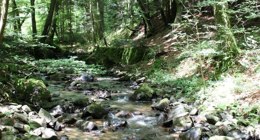
Step 4 : Leave the road (before a small house on the left) and turn right onto a scrubby track and then a steep path through the forest. Cross a stream and climb left to a road. Turn left and follow it to the hamlet of Les Arbres. Go straight ahead and at Malmouche, turn right, then after 100 m (information table and view of Menat) down a track to the right. At the road, turn left onto the D2144. Cross over to the Menat road. Climb up to the church (Cluniac site, Romanesque church and cloisters) and return to the starting point.
Proposed and managed by the Conseil départemental du Puy-de-Dôme – PDIPR.
/* col-6_sm-12 */ ?>
Opening hours
All year round daily.
Subject to favorable weather.
Comfort, facilities and services
- Pets welcome
Additional information
For your own safety, always take a bottle of water, a hat, warm clothing and footwear suitable for walking.
Depending on weather conditions, certain itineraries are not recommended in bad weather (fog) or are not practicable, or even forbidden, during the winter season.
Some sites are fragile, so stay on the marked trails. Avoid picking wild flowers and disturbing wildlife. Pick up your garbage.
Animals are not allowed on some routes.
Dogs allowed Dogs must be kept on a lead due to the presence of herds.
Environment
Presence of livestock and guard dogs
Access
On the D2144 between Combronde and Saint-Éloy-les-Mines, at Château-Gaillard, turn towards Menat and drive past the church and the town hall square. Car park and signpost at Place de la Poste and Place de l’école.
Downloadable :
Photo credits : Office de Tourisme des Combrailles, Office de Tourisme des Combrailles, Office de Tourisme des Combrailles