![]()
In the footsteps of the Carthusian monks
Chapdes-Beaufort
 Dogs allowed
Distance 22Km
Duration 6h30
Hiking route BOUCLE
Marking Green
In pictures
Route description
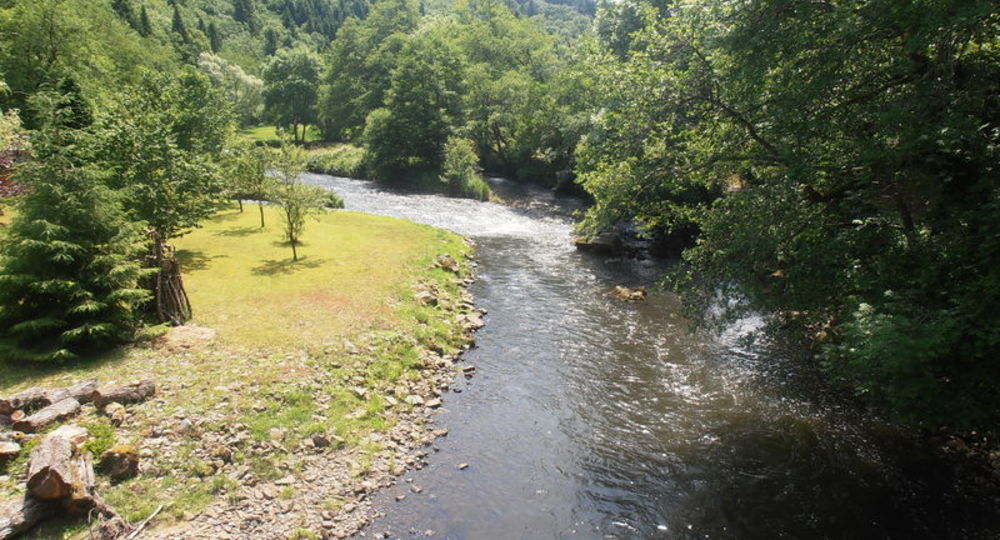
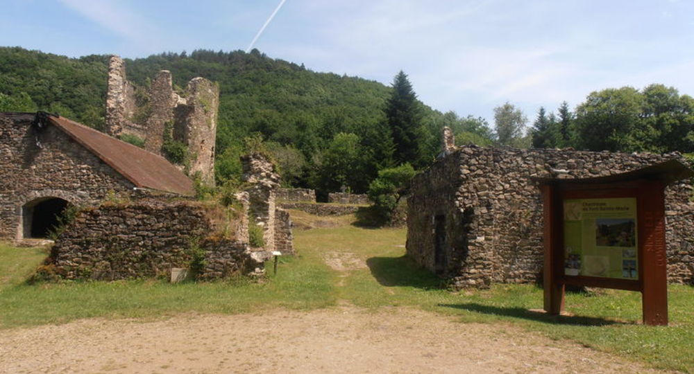
The ruins of the Carthusian monastery at Port-Sainte-Marie and a characteristic vernacular heritage are a delight to walkers. The route follows the Sioule through magnificent gorges and then onto the Combrailles plateaux. There are wonderful views of the Puys mountain range.
Trail highlights
– Moulin de Mazière.
– Viewpoint over the Sancy.
– Ruins of the Carthusian monastery at Port-Sainte-Marie.
– The Sioule.
– Chabanne mill.
Guidebook with maps/step-by-step
Step 1 : With your back to the start sign, turn right into rue des Bruyères. Turn right in front of the transformer, then take the left-hand path, cross the road and continue straight ahead. At the crossroads, fork left ; the path passes under a high-voltage power line and descends through the woods to the Mazière mill. Cross the stream and climb up to the D 418 road.
Step 2 : Cross the road and take the path opposite. At the summit (viewpoint over the Sancy), go straight on to a crow’s-foot. Turn right to join the road and follow it for 150 m. At the crossroads, leave the road and take the path on the right. At the next crossroads, turn left, pass under the high-voltage power line and continue as far as the village of Triolet. Take the right-hand track and follow it to the edge of the wood. Bend left to take a track that descends gently for 1.8 km to a crossroads (off-course, 100 m to the right, ruins of the Chartreuse de Port-Sainte-Marie).
Step 3 : Turn left at the road (don’t take it) and continue on the track immediately to your left, which winds its way up the Sioule for about 3 km to a crossroads (signposts).
Step 4 : Leave the right-hand track (another PR) and go straight up, parallel to the high-voltage power line. Pass under it and turn right towards the village of Les Bouchauds. Take the road on the left (viewpoint over the Chaîne des Puys) to a crossroads. Turn right, then at the next crossroads, in front of a farmhouse, turn right onto a road for 200 m, then left onto a path to the village of Rioux. Cross the village and, opposite the last house, turn left onto a path between hedges. Go downhill until you reach the road, then continue straight ahead. At a track junction, keep right and join a tarmac path in a wide bend.
Next step
Step 5 : Turn left, climb 400 m and fork left onto a track. On the plateau, continue on this track (viewpoint) until you reach a road (stone cross). Turn right for 40 m, then left on a track that descends to the bottom of the valley. Cross a stream on a footbridge and climb back up to the plateau. Continue straight on to the hamlet of Les Barrats. Take the road to the left, and at the stone cross, fork left onto the track and follow it to the Chabanne mill.
Step 6 : Cross the stream and follow the path up to a stone cross 250 m away. Take the track that runs off to the left between the trees. Pass a farm and a pumping station, and continue straight ahead to reach the starting point.
Proposed and managed by the Conseil départemental du Puy-de-Dôme – PDIPR.
/* col-6_sm-12 */ ?>
Opening hours
All year round daily.
Subject to favorable weather.
Comfort, facilities and services
- Pets welcome
Additional information
For your own safety, always take a bottle of water, a hat, warm clothing and footwear suitable for walking.
Depending on weather conditions, certain itineraries are not recommended in bad weather (fog) or are not practicable, or even forbidden, during the winter season.
Some sites are fragile, so stay on the marked trails. Avoid picking wild flowers and disturbing wildlife. Pick up your garbage.
Animals are not allowed on some routes.
Dogs allowed Dogs must be kept on a leash due to the presence of herds.
Environment
In the country, Forest location, Presence of livestock and guard dogs
Access
From Saint-Ours-les-Roches (east of Pontgibaud) take the D62 to Chapdes-Beaufort. Parking lot at Place de l’Église.
Downloadable :
Photo credits : Office de Tourisme des Combrailles, Office de Tourisme des Combrailles