
Tableix
Blot-l’Église
 Dogs allowed
Distance 16Km
Duration 4h45
Hiking route BOUCLE
Marking Green
In pictures


Route description
From the Blot-l’Église stadium, head for the Étang Magaud, a fishing and leisure lake, and enjoy the panoramic view over the Sioule Gorges.
Trail highlights
Blot l’Église – Magaud pond
Guidebook with maps/step-by-step
Step 122 : Turn right after the stadium. Follow the road to the left for 50m, then turn right onto a wide track. Go straight ahead and, at the intersection 200m after the forest, take the track on the right. At the fork in the forest, keep left. Ignore 2 left-hand paths. At the next crossroads, continue straight ahead until you reach an intersection with a meadow (view of the Combrailles).
Step 1 : Turn left. Stay on the main track and descend to a T-junction. Continue downhill to the road (Tableix village). Follow it to the left. Reach a main road. Climb to the left (view of the Sioule valley). At the crossroads, turn left onto the grassy path that joins a road below. Follow it to the left. At the bend on the right, turn left up a wide track. At the crossroads, continue uphill to the left. Leave a track on your left and reach a road. Turn left and then left again. Continue on a wide track. Go through a wood and downhill to an intersection.
Step 2 : Continue downhill to the right until you reach a road. Cross the road and continue towards Manzat. Cross a stream. As you climb, take the first path on the right. At the fork, continue right to the access road to Etang Magaud (picnic area, Etang Magaud).
Step 3 : Turn left into a hairpin bend and follow the pond on your right. Drive up to the entrance to Montgondol and immediately turn left. At the next crossroads, turn left, then immediately right on the downhill path. Drive alongside a small pond on your left. At the T-junction, turn left. Continue on the main track. Cross a stream. Cross a road and reach the main road through Villemorie.
Follow it to the right for 100m, then turn right down Rue des Lavandières to a fork in the road.
Next step
Step 4 : Go up to the left. At the second fork, turn right. At the T-junction, turn right. Continue, leaving a path on your left (viewpoint). At the intersection of three signposted circuits, turn left to reach a road. Follow it to the left and take the first track on the left. At the fork, go right through the woods to the road. Turn left for 10 m, then right through a gate onto a forest track. Leave a wide track on the right. Go through the wood exit barrier and immediately take the wide track on the left.
At the junction of four tracks, turn left towards the Centre Equestre (Les Frisons de l’Ambène) and Château de Blot, which is very close to the starting point.
Opening hours
All year round daily.
Comfort, facilities and services
- Pets welcome
Additional information
For your own safety, always take a bottle of water, a hat, warm clothing and footwear suitable for walking.
Depending on weather conditions, certain itineraries are not recommended in bad weather (fog) or are not practicable, or even forbidden, during the winter season.
Some sites are fragile, so stay on the marked trails. Avoid picking wild flowers and disturbing wildlife. Pick up your garbage.
Animals are not allowed on some routes.
Dogs allowed Dogs must be kept on a leash due to the presence of herds.
Environment
In the country
Access
Blot-l’Eglise, 44km north of Clermont-Ferrand. Start sign on the D122 at the crossroads opposite the stadium.
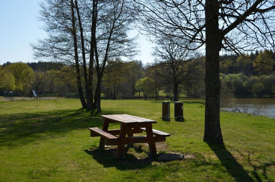
Photo credits :
 Updated on 5 May 2025 by Office de Tourisme des Combrailles