
Saint Coust Priory
Châtel-Guyon
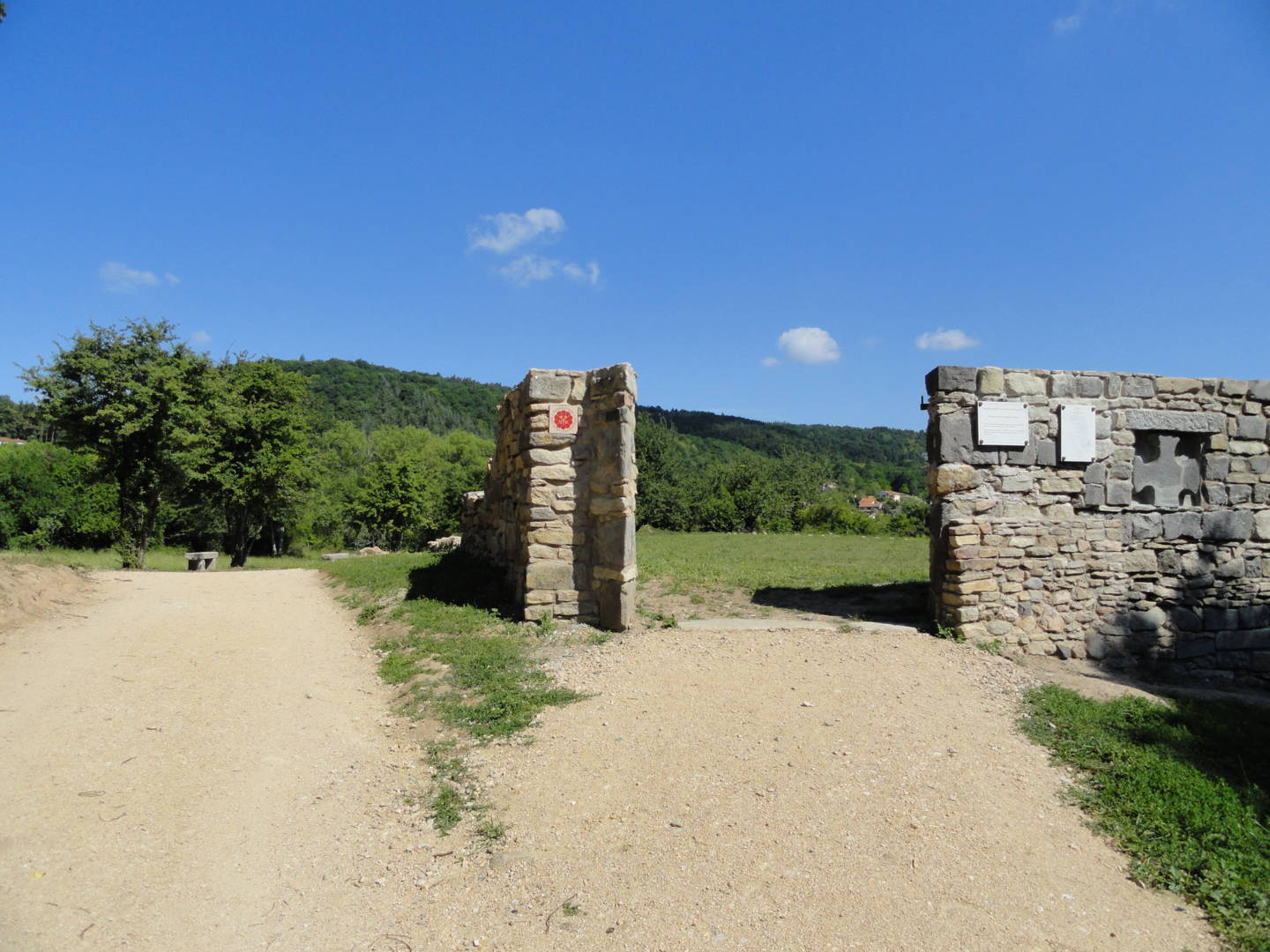
Saint Coust Priory has been part of the network of Cluniac sites since 2010.
In Gallia Christiana (Tomme II, p. 411), Saint Coust is mentioned as a foundation of the Cluniac abbey of Mozac. The first quotation “Ecclesiam de Sana Cultura” appears in an undated placard from Adrian IV, Pope from 1154 to 1159, which specifies and confirms the Mozac processions. The same quotation(…)
In Gallia Christiana (Tomme II, p. 411), Saint Coust is mentioned as a foundation of the Cluniac abbey of Mozac. The first quotation “Ecclesiam de Sana Cultura” appears in an undated placard from Adrian IV, Pope from 1154 to 1159, which specifies and confirms the Mozac processions. The same quotation appears in a confirmation of the abbey’s possessions and privileges by Pope Alexander III in 1160. Saint Coust therefore existed in the middle of the 12th century.
The most likely hypothesis is that the abbey was founded in the first half of the 12th century, at a time of major land clearing and demographic expansion throughout the medieval West, and at a time when the Gregorian reform was flourishing in the Church. A more or less scattered settlement would then have existed around the new church on a platform favorable to vines, at the junction of the plateau foothills and the Limagne plain, close to springs, the Chambaron stream and the forest on the plateau. In addition, on the nearby Fugeasseix hill to the east, oral tradition has it that there was an ancient village.
The village seems to have been abandoned long ago, mainly due to the emergence and expansion of a castle town 1 km to the south, at the foot of the castle of Count Guy II of Auvergne, Chastel-Guion, at the beginning of the 13th century, less than a century after the first known mention of Saint-Coust. A chapel dedicated to Saint Maurice and appointed by the Abbot of Mozac was built against the castle mound.
This decline was accentuated by the plague epidemics of 1401 and 1631. The survivors joined the castle town and the new hamlet of Grosliers, 1 km to the north, founded in the 16th century.
By 1698, the church of Saint-Coust appeared to be disused, or at least little used, and was closed to worship in 1721. The French Revolution of 1789 completed the slow decline that had begun in the late Middle Ages. At the beginning of 1792, Saint-Coust was suppressed without opposition from the municipal officers, who blamed the Abbé de Mozac for the building’s dilapidation, and probably a large part of the inhabitants themselves.
The parish enclosure was then sold as national property.
Saving a site from oblivion
(Excerpt from Châtel-Guyon – Le Prieuré Clunisien de Saint-Coust by Histoire et Patrimoine – Guy Veillet – September 27, 2013)
In the Middle Ages : “In the northern part of the commune, about 1km from the present-day village (Vieux Châtel), in the La Rochette area, lies the locality of Saint-Coust, pronounced “san’coult” by the peasants. Etymology provides some clues : in fact, no saint bears the patronymic of Coust. The Latin expression “Sana Cultura” can thus be interpreted as healthy and good culture if we consider the agricultural activities of the place, or as wise cult or wisdom or true cult if we place ourselves on a more moral level, or as a mixture of these two without”.
Another hypothesis is that the word “saint”, pronounced “san'”, is closer to “sagne”, meaning swamp. However, a wetland and a spring now tapped by a well, as well as the proximity of the Chambaron stream, confirm the presence of water in an agricultural terroir.
“The Saint-Coust terroir was created at the time of the great land clearings and demographic boom throughout the medieval West between the 11th and 13th centuries. According to oral tradition, there was a village on the Fugeasseix hill near Saint-Coust as early as the end of the 11th century, of which no trace remains. In addition, a more or less scattered settlement is said to have existed at the foot of the mound.”
The mound was later farmed in large plots of arable land, and at its foot were small plots of land in strips cultivated with vines, as shown in the Napoleonic cadastre of 1809.
The priory : a priory was founded in the Saint-Cousr area, at the foot of the Fugeasseix hill. Its church was the seat of the first parish. In Gallia Christiana (Volume II), Saint-Coust is mentioned as a foundation of the Cluniac abbey of Mozac. The first quotation “Ecclesiam de Sana Cultura” appears in an undated placard from Adrian IV, pope from 1154 to 1159, which specifies and confirms the possessions of the Mozac abbey. The same quotation appears in a confirmation of the abbey’s possessions and privileges by Pope Alexander III in 1160.
The priory therefore existed in the middle of the 12th century. Its date of foundation remains unknown.
The most likely hypothesis is that it was founded in the first half of the 12th century, when the Gregorian reform was taking hold in the church.
Mozac Abbey’s possessions were confirmed in 1169 by King Louis VII, in 1217 by Philippe-Auguste, in 1224 by Louis VIII, in 1269 by Saint-Louis, in 1460 by Charles VII and in 1490 by Charles VIII.
The priory belongs to this last great wave of parish settlements, which took place between the 11th and 13th centuries, when the region was fully populated. The scattered settlement at the foot of the Fugeasseix mound surrounds the priory church.
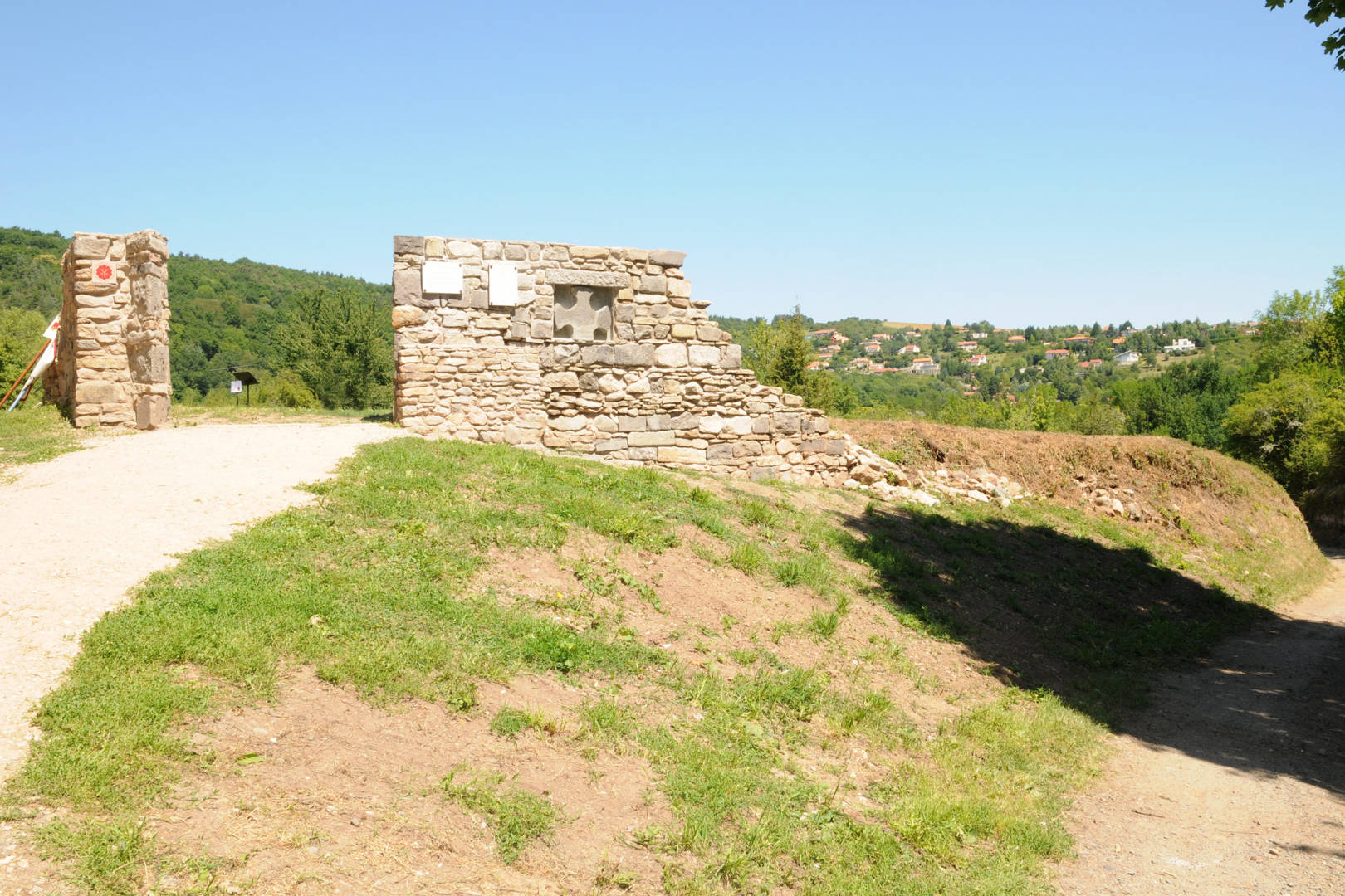
The church and its adjoining cemetery are set on a platform in an oval enclosure covering an area of 1100m².
The church : rectangular in plan, it covers an area of 227m² (19.50 m long by 11.50 m wide). The steeple was almost 8 m high. The modest dimensions of this church are explained by the small size of the parish, initially limited to the site of Saint-Coust ; however, the parish priest was later assisted by a sub-prior. The list of incumbents of the parish of Saint-Coust-Chastelguio (spelling mentioned in 1416) is only known from this date.
The cemetery : adjoining the church, it covers around 410m² : this does not correspond to the entire enclosure that still exists today, which is around 1100m². Several hypotheses are therefore possible : part of this enclosure was vacant or reserved for another use, or it marked the site of structures that had disappeared in the past.
A slow decline : the abandonment of the village on the Fugeasseix hill and around the priory appears to have been a long time in the making : it can be explained mainly by the birth and expansion of a new site. Less than a century after the first known mention of Saint-Coust, Gui II Count of Auvergne built a castle at the end of the 12th century, one km south of Saint-Coust. A castral village named after the castle grew up at its foot, at the beginning of the 13th century.
The clay soils and lack of hillsides made it difficult to grow vines or build wine cellars.
This decline was exacerbated by a plague epidemic at the very beginning of the 15th century, in 1401.
From the Renaissance to the Revolution
Site abandonment : “The decline, which began in the late Middle Ages, continued following the great plague epidemic in the first half of the 17th century, in 1631. Most of the survivors moved to the castle town and, to a lesser extent, to the hamlet of Les Grosliers, one km to the north. The age of Les Grosliers is unknown, but the hamlet existed before the 17th century, as proven by texts dating from 1661. There is no evidence of a village fort.
The existence of these two poles : the castral village and the more fertile, cellar-dwelling and sheltered hamlet of Les Grosliers, explains the departure and dispersal of the population of Saint-Coust, which survived the plague epidemics.
The parish church of Saint-Coust appears to have been disused, or at least little used, as early as 1698, and was closed to worship in 1721 following an episcopal visit, which led to the banning of the building and cemetery until major repairs had been carried out. No such repairs were ever carried out. In 1698, it seems that the parish priest was still baptizing at Saint-Coust, since he obtained permission from the bishop to build a baptismal font in the village chapel.
Burials continued to take place in the church : between 1709 and 1724, four burials were recorded.
The Revolution of 1789 completed this slow decline. At the beginning of 1792, the priory of Saint-Coust was suppressed without opposition from the municipal officers, who blamed the Abbé de Mozac for the building’s dilapidation. The two bells were removed to be melted down and turned into cannons for the young revolutionary army. In 1796, the entire priory was sold as national property to Marien Levadoux, a farmer from Châtel-Guyon.
The 19th and 20th centuries saw the ruin and complete abandonment of the priory. The cemetery was replaced by a vineyard and its shed or “tonne”, built on the site of the church choir.
The vineyard having been abandoned in its turn, the site disappeared under thick vegetation that had once again become wild.
A long-awaited restoration
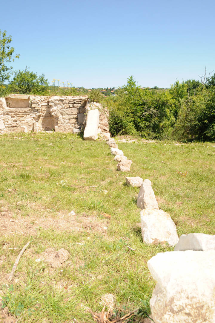
The clearing of the enclosure, carried out in autumn 2009, made it possible to follow the line of the enclosing wall and to clear the north and west walls of the church over an elevation of two metres.
“The stones used are granite, andesite, arkose or even bad limestone rubble, apparently quarried locally or regionally. The stones are irregular in size, jointed with lime mortar and quarry gravel. However, lower down on the outside of the building on the north side, you can see the base of the northeast and northwest corners of the construction : large andesite and granite blocks show the solidity and importance of the building, whose medieval base level is at least one metre below the current enclosure level. There’s a thick archaeological layer here, which the bushes must have damaged.
In addition, the old vineyards cultivated in the enclosure must have damaged the cemetery. In 1900, several skeletons were discovered in the enclosure. In 1900, the oldest inhabitants of the commune remember seeing the owners of the land extracting quite a few bones.”
Conservation work
In addition to clearing undergrowth from the priory enclosure, the development of the Saint-Coust site has been entrusted to the Chantier d’Insertion INSERFAC, with logistical and technical support from the Commune’s municipal services, and in collaboration with the ADEP heritage section.
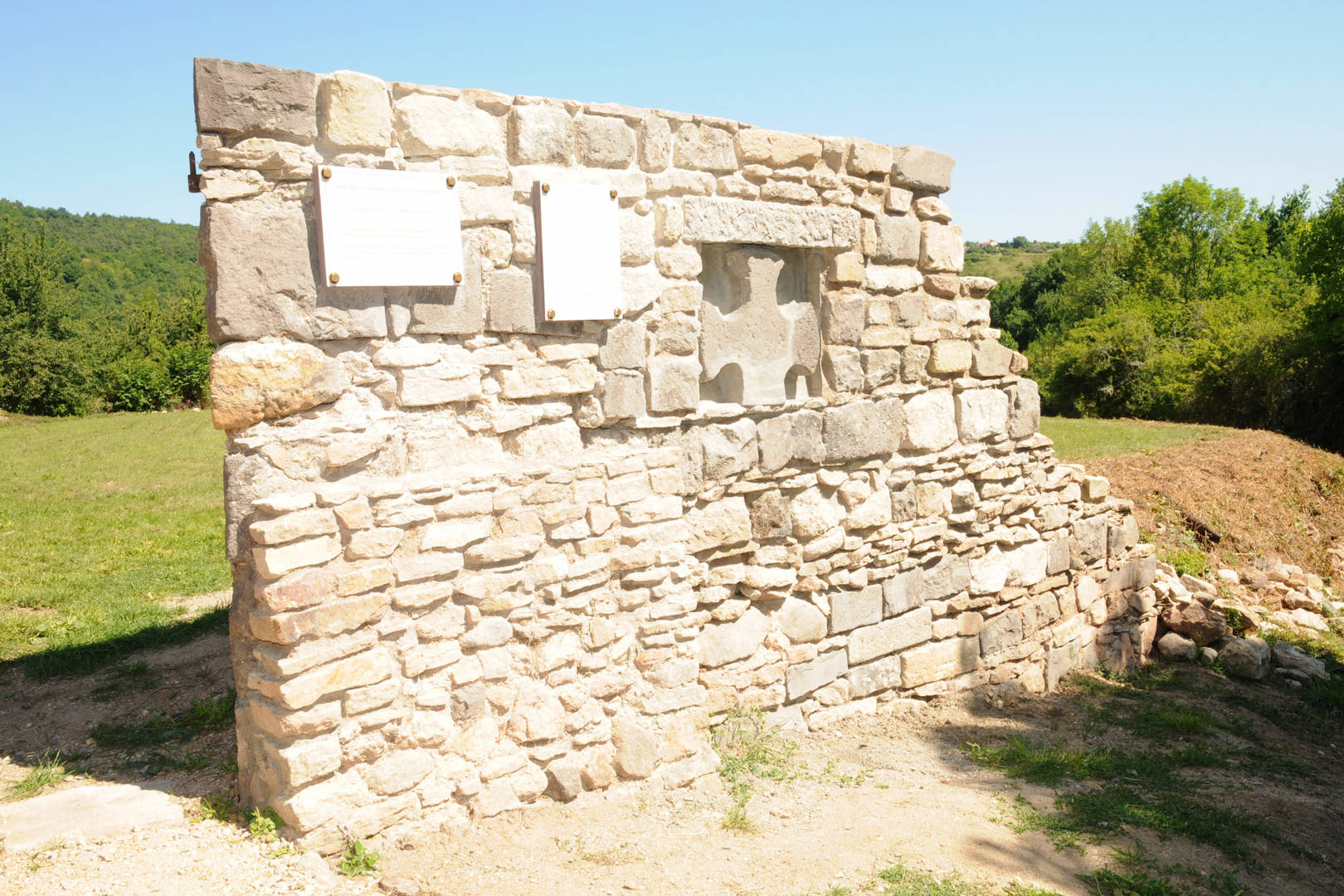
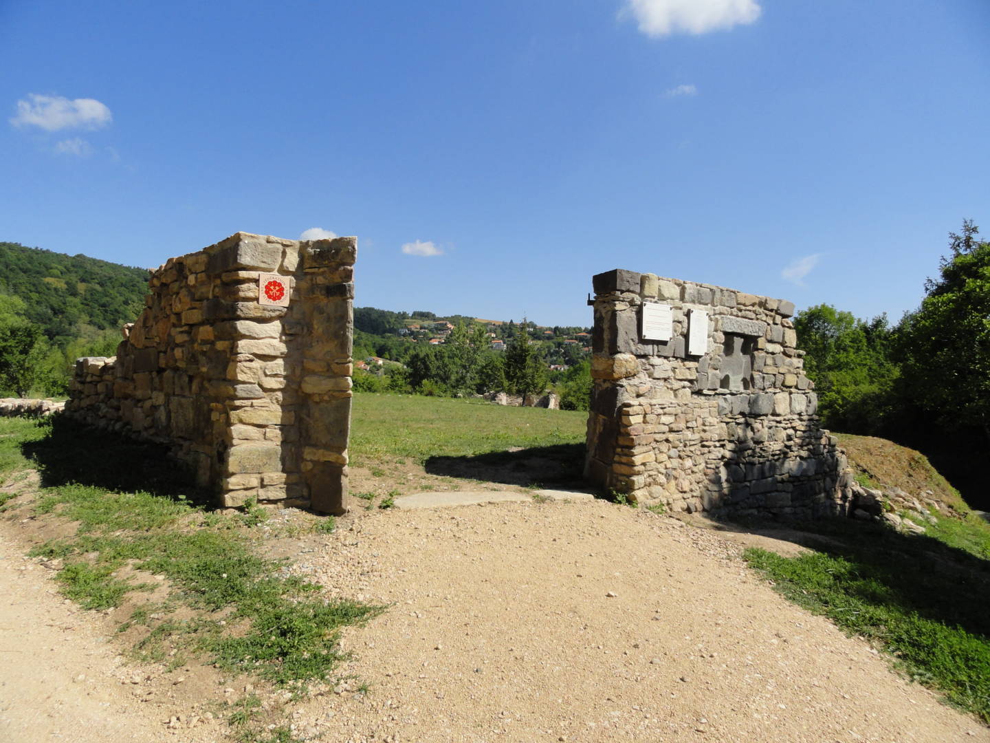
Starting in spring 2010, work was carried out on the periphery of the enclosure : reconstruction of the entrance with the installation of a cross and signage, and clearing of the church choir.
During the 2010-2011 works campaign, the partial clearing of the enclosure wall around the perimeter will be continued. A pathway, already underway, will eventually enable visitors to walk around the enclosure.
The official inauguration of the site on June 25, 2011 was attended by the President of the European Federation of Cluniac Sites.
In 2012-2013, the east wall of the church (choir) was extended : the south wall was marked out on the ground. Finally, the entire choir is currently being restored.
Long-term prospects
Excavation of the cemetery is out of the question.
Excavation of the church is subject to the availability of a professional archaeologist and to the Commune’s budgetary resources. However, test pits could be undertaken. Excavation of the enclosure walls will continue until the end of 2015.
Lastly, the site has been designated a natural and historic site, and was included in the Local Urban Plan in 2011. It is regularly secured and maintained by the Commune, with the support of the Conseil Général du Puy de Dôme.
Spoken languages
Opening hours
All year round daily.
Prices and payment methods
- Free access.
Comfort, facilities and services
- Car park
Location
Environnements
Thermal resort
- Boulevard Nord
63140 Châtel-Guyon - sitesclunisiens.org
- Calculate your route
Photo credits : Mairie de Châtel-Guyon, Mairie de Châtel-Guyon, Mairie de Châtel-Guyon, Mairie de Châtel-Guyon, Mairie de Châtel-Guyon
 Updated on 27 January 2022 by Office de Tourisme Terra Volcana, les Pays de Volvic