![]()
Wine tourism circuit around Châteaugay
Châteaugay
 Dogs allowed
Distance 5.5Km
Duration 2h00
Hiking route BOUCLE
Marking Vignoble et Découverte” signposting
In pictures
Route description
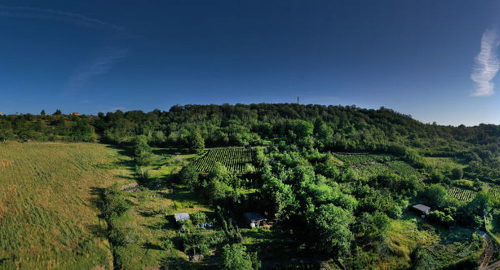
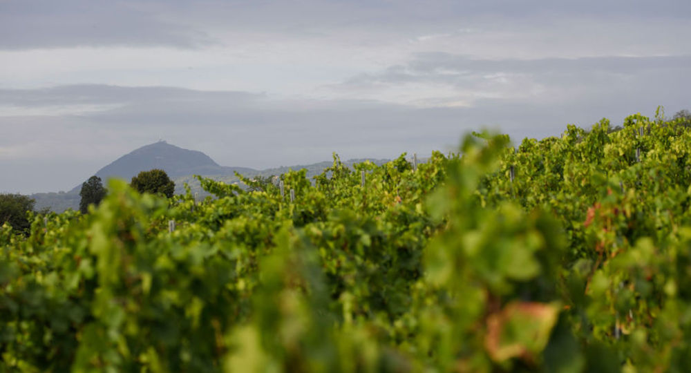
On the slopes of the dormant volcanoes of the Chaîne des Puys, vines take root between basalt, granite and clay-limestone soils, giving life to wines with multiple tonalities and a strong identity.
Trail highlights
– 13th-century Château de Châteaugay.
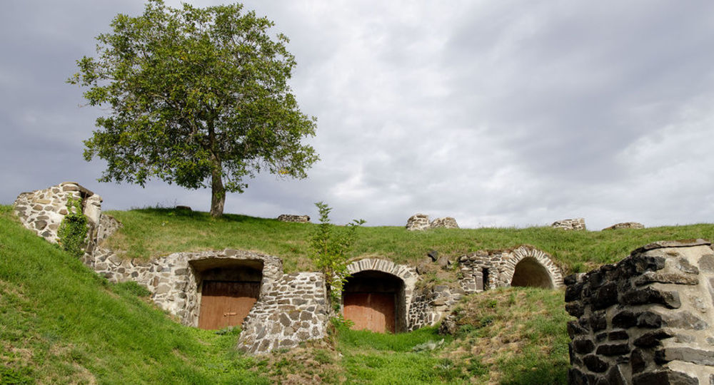
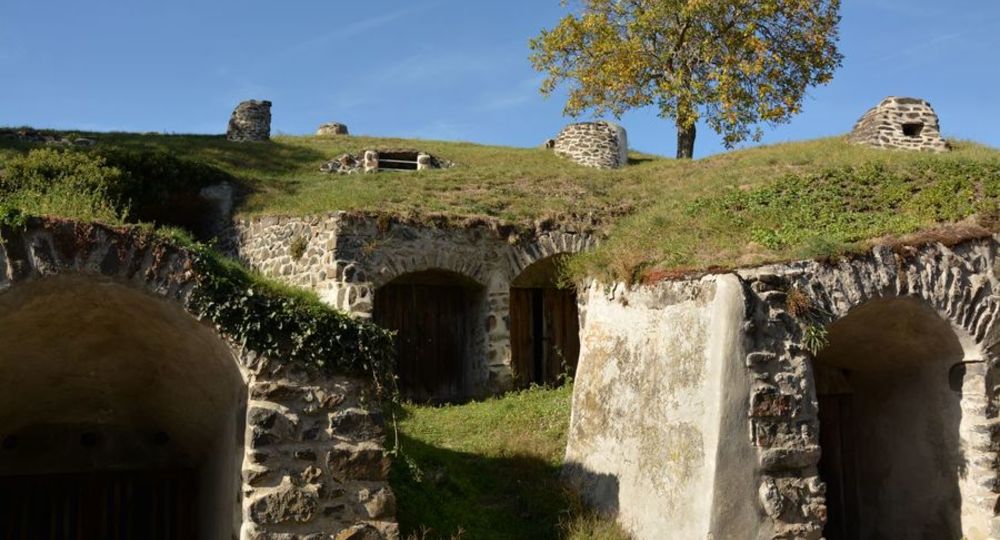
– The winegrowing village of Châteaugay and its underground cellars.
– Exceptional view from the Champ-Griaud plateau.
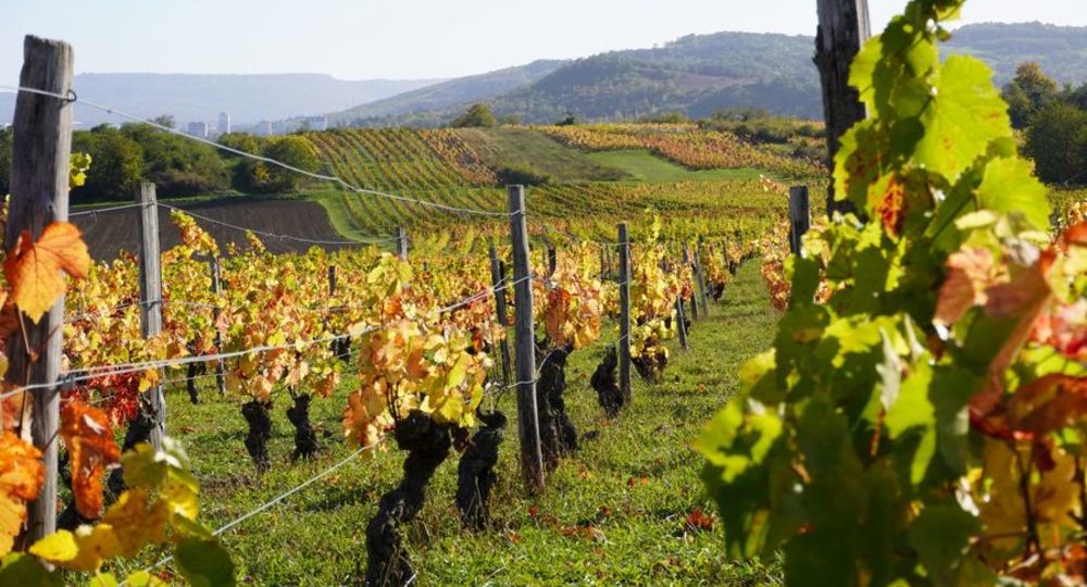
– Immersion in the Châteaugay vineyards.
Guidebook with maps/step-by-step
Step 1 : From the start sign, cross Parc Jay, at the far left, go down the steps towards Place François Rougeyron, then cross the road towards the porch. Cross the porch into Rue du Château, to the left of the Vigosche restaurant. Continue along the street, skirting the château to the left and passing under the second porch. Follow the road to the next crossroads, then fork right under the low stone wall.
Continue until you reach the Châteaugay winegrowers’ union building (1st information panel). Continue along the road as far as rue de la Garenne, then fork right for a round trip and a panoramic view of the Chaîne des Puys, the Livradois and the village of Chateaugay.
At the crossroads, take the central path alongside the tree-lined square. After about 20 m, go down Rue du Chalard.
Step 2 : Follow the cellars (2nd information panel on the Lascombe Mesclier cellar). Continue until you come to a fork in the road going up on the left. About 50 m further up, take the first grassy path on your right. View of the Ladoux slopes, the Limagne plain and the Monts du Forez. Ten or so metres before you reach the next crossroads, turn right towards the calvary on the hill to discover a 360° panoramic view (Chaîne des puys, Monts du Forez, Chanturgue, Gergovie). Follow the path below, which has two wooden barriers to prevent access by two-wheelers. Continue along the path, past the soccer stadium, until you come to a small downhill path bordered by a handmade railing and a low stone wall. Follow the path downhill to the gravel road, then turn left. After about 20 m, leave the road and turn right onto the grassy path. At the Conseil départemental sign, you’ll see Châteaugay castle and the Chaîne des puys. Continue along the path until you reach the gravelled Roman road, then turn right up the road.
Step 3 : Follow the Roman road to the ASAC sign for the Chapelières path (Chemin de la croix Arpin) and turn right onto the path (be careful not to slip). At the bottom of the track, fork right, then turn left onto the grassy path.
Step 4 : At the end of the path, on the gravel road, turn left, then left again at the crossroads. Continue along the asphalt road, forking right and skirting the vineyards on either side of the path. At the next fork in the path, turn right and continue along the vineyards, staying on the gravel road.
Next step
Step 5 : Follow the path straight ahead until you reach the tarmac road. At the first crossroads, continue straight ahead.
Step 6 : At the second crossroads, turn right up the road (watch out for traffic for a few hundred metres until you see a dead-end road on the left). Enter the dead-end and take the stairs. At the top of the stairs, cross the road and continue towards the town center, then climb the next set of stairs. Continue straight ahead, following the signs for the château. Twenty meters before the stairs, turn left. Go up the street and cross the road. Opposite Parc Jay, cross the road to reach the parking lot again.
Proposed and managed by the Conseil départemental du Puy-de-Dôme – PDIPR.
/* col-6_sm-12 */ ?>
Opening hours
All year round daily.
Subject to favorable weather.
Comfort, facilities and services
- Pets welcome
Additional information
For your own safety, always take a bottle of water, a hat, warm clothing and footwear suitable for walking.
Depending on weather conditions, certain itineraries are not recommended in bad weather (fog) or are not practicable, or even forbidden, during the winter season.
Some sites are fragile, so stay on the marked trails. Avoid picking wild flowers and disturbing wildlife. Pick up your litter.
Dogs allowed Pets allowed on leash.
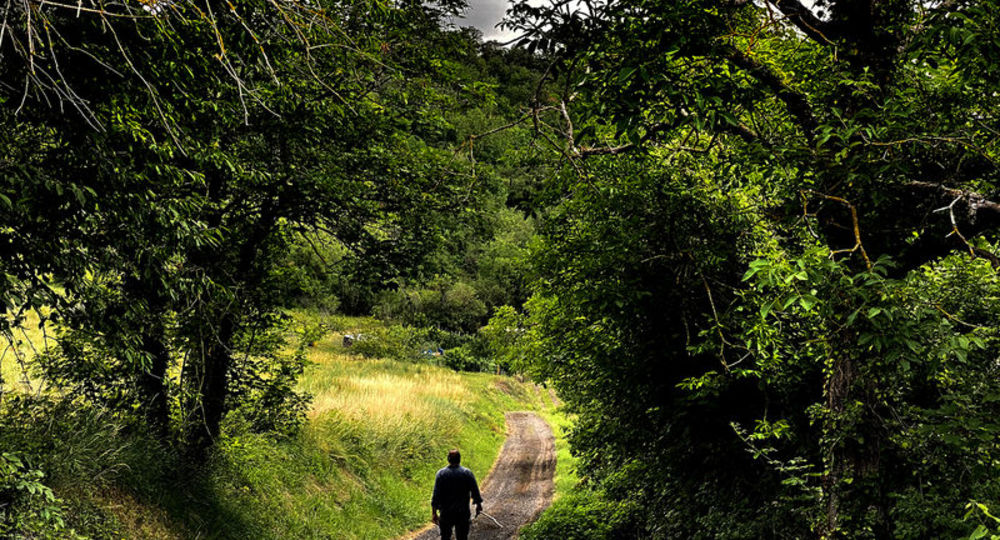
Environment
Village centre, View over the vineyards
Access
From Clermont-Ferrand, follow signs for Riom on the D2009. Turn left at the Châteaugay exit on the D402. Enter Châteaugay, parking Charles-de-Gaulles on right. Start sign in Parc Jay next to the parking lot.
Downloadable :
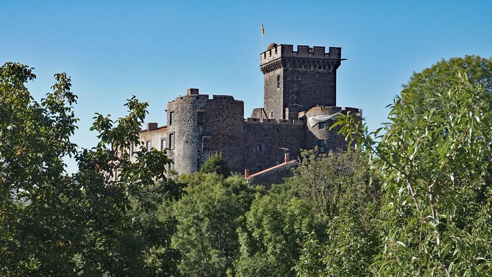
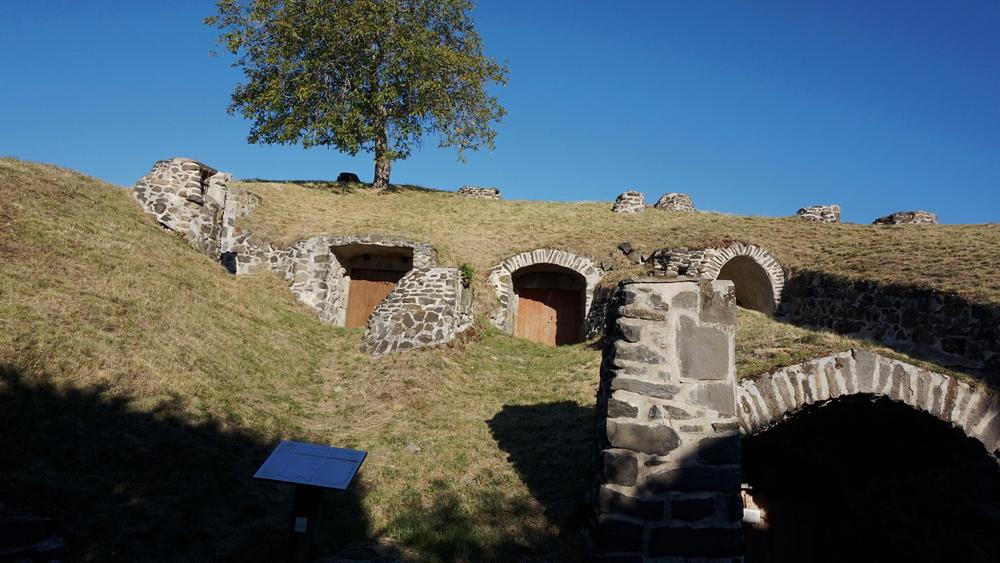
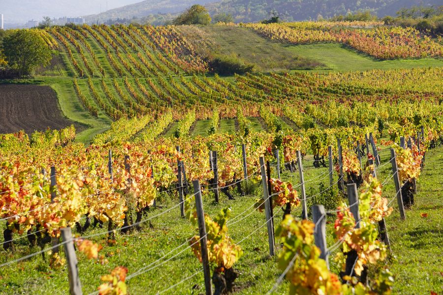
Photo credits : Denis Pourcher, Ludovic Combe, CD63 / C.Bachelerie, Denis Pourcher, Ludovic Combe, CD63/A.Péronnet