![]()
La cheire de Tournebise – Lea and Tino’s walks
Saint-Pierre-le-Chastel
 No dogs allowed
Distance 3.7Km
Duration 1h15
Hiking route BOUCLE
Marking Butterfly
In pictures


Route description
A breathtakingly beautiful walk through the mysterious world of volcanic cheires, with their chaos of piles of slag, moss and lichen. You’ll also discover the remains of a mysterious medieval city, the Chazaloux camp.
Trail highlights
– Tournebise forest.
– Views of the Banne d’Ordanche.
– Views of the Dôme and Côme puys
Guidebook with maps/step-by-step
Step 1 : From the start sign, take the path into the forest of the cheire de Tournebise, part of the cheire de Côme (information on this, 20m after the start). 150m further on, the path begins to cross the Chazaloux medieval site (5mn AR from the intersection, on the right and left, interpretations of the traces of the buildings). Continue straight ahead until you reach the fork at the end of the site. Go right and, at the next fork, go left. At the third fork, go right to a Y intersection.
Step 2 : Go right, and at the next fork, go left. At the fork in the road, go right and, after 30 m, continue to the right. Continue along a clearing with ruined buildings. Ignore the paths to the left and right. Pass a parking lot at the edge of the forest. Stay on the main path, ignoring the side paths. Before the houses, views of the Banne d’Ordanche and, 30m further on, the Dôme and Côme puys. Continue to the road.
Step 3 : Turn right. At the next crossroads, leave Rue des Clidelles and take the road to the right. Drive past farm buildings. At the parking sign, return to the start.
Proposed and managed by the Conseil départemental du Puy-de-Dôme – PDIPR.
/* col-6_sm-12 */ ?>
Opening hours
All year round daily.
Subject to favorable weather.
Additional information
For your own safety, always take a bottle of water, a hat, warm clothing and footwear suitable for walking.
Depending on weather conditions, certain itineraries are not recommended in bad weather (fog) or are not practicable, or even forbidden, during the winter season.
Some sites are fragile, so stay on the marked trails. Avoid picking wild flowers and disturbing wildlife. Pick up your garbage.
Animals are not allowed on some routes.
Environment
In the country, Mountain view
Access
Take the D941 to Bannières, 25 km west of Clermont-Ferrand. At La Courteix, turn left onto the D62 to Bannières. Turn right onto Rue du Puy de Dôme and, at the watering place, turn right onto Route des Fermes as far as the Parking sign. Turn right onto a carriage road leading to the start sign.
Downloadable :
You might also like…
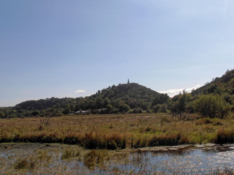
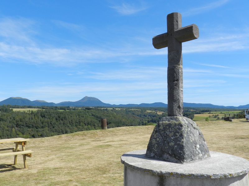
Photo credits : Office de Tourisme des Combrailles, Office de Tourisme des Combrailles, Office de Tourisme des Combrailles