![]()
The Ternant cross
Chanat-la-Mouteyre
 Dogs allowed
Distance 13.5Km
Duration 4h00
Hiking route BOUCLE
Marking green
In pictures
Route description
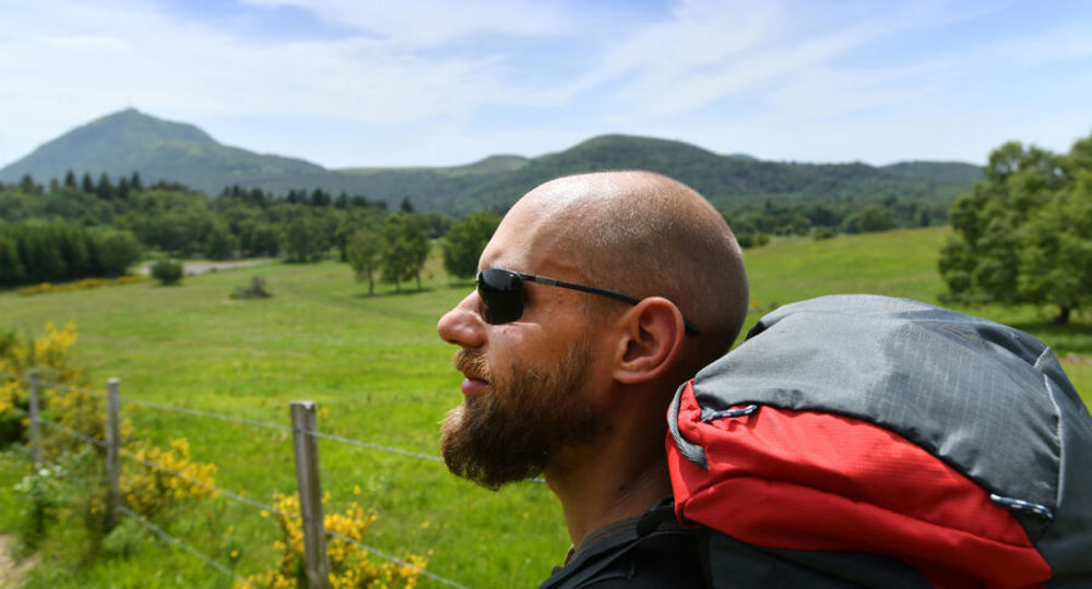
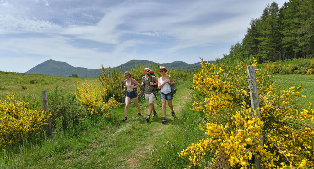
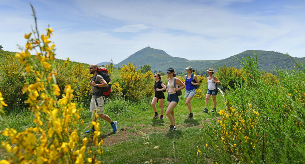
The walk climbs to an altitude of 1,005 meters, offering an unrivalled range of landscapes over the Limagne plain, the Forez mountains, the city of Clermont-Ferrand, the Sancy massif, the Puys chain and the Puy de Dôme.
Trail highlights
View of the Limagne plain, the Forez mountains, the town of Clermont-Ferrand, the Sancy massif, the Puys chain and the puy de Dôme, Ternant cross.
Guidebook with maps/step-by-step
Step 1 : Go up Rue du Chancet and take the first path on the left (view of the Limagne plain, the Côtes de Clermont and the Forez mountains). Go downhill to a T-junction, then turn right. At the road, take the path on the right. After passing through undergrowth, reach the road, cross it and follow it to the right for 50 m. At the “L’Etang” sign, take the path behind the guardrail. Cross another road, go straight ahead on the track and keep to the left as far as the crossroads at the entrance to La Mouteyre.
Step 2 : Turn left onto Rue des Sagnes, which becomes a track. Cross a stream, ignore two paths on the left and take the first path on the right. At the top of the hill, at the “patte d’oie” (goose foot), continue straight ahead on the small road to the Ternant church.
Step 3 : Take rue de l’Église Neuve, then turn left onto the road. Turn right onto rue de la Riveux ; after 50 m, turn left onto rue des Sagnes, which continues along a track. At the first crossroads, go up to the right and turn right at the crossroads. Continue along this path until you reach the road.
Step 4 : Cross the road, take the chicane and climb between two fences (view of the Puy de Dôme, part of the Chaîne des Puys) to the summit (AR on the right, 50 m further on, the Ternant cross and view of the Limagne plain, the Forez mountains, the town of Clermont-Ferrand, the Sancy massif, the Chaîne des Puys and the Puy de Dôme). Continue straight ahead until you reach a chicane. Cross it and descend to the left at the edge of the forest. At the bottom of the descent, at the crossroads, turn right onto the track which slopes gently down to a road.
Next step
Step 5 : Cross the road and continue straight ahead. Go straight on for 1 km, then, after a wooded area, turn right onto a wide path between fences. Go straight on to the stadium. Continue past the stadium and down into the village of Chanat. Take Avenue des Volcans, cross Place de l’Arbre Commun, go down opposite and then left. Go straight ahead at the square. Pass between the playground and the fire department building. Turn right along the D775 towards the sculpture (view of the Limagne plain, Bourbonnais and Forez mountains). Turn right, cross the footbridge and walk up Rue des Crozes to reach the parking lot.
Proposed and managed by the Conseil départemental du Puy-de-Dôme – PDIPR.
/* col-6_sm-12 */ ?>
Opening hours
From 01/01 to 31/12 daily.
Subject to favorable weather.
Comfort, facilities and services
- Car park
- Pets welcome
Additional information
For your own safety, always take a bottle of water, a hat, warm clothing and footwear suitable for walking.
Depending on weather conditions, certain itineraries are not recommended in bad weather (fog) or are not practicable, or even forbidden, during the winter season.
Some sites are fragile, so stay on the marked trails. Avoid picking wild flowers and disturbing wildlife. Pick up your garbage.
Animals are not allowed on some routes.
Dogs allowed Dogs must be kept on a leash due to the presence of herds.
Environment
In the country, Mountain view, Presence of livestock and guard dogs
Access
From Durtol (western suburb of Clermont-Ferrand) take the D943 towards Volvic, then the D775 to the village of Chanat-la-Mouteyre. Parking lot above the Chanat-la-Mouteyre church.
Downloadable :
You might also like…
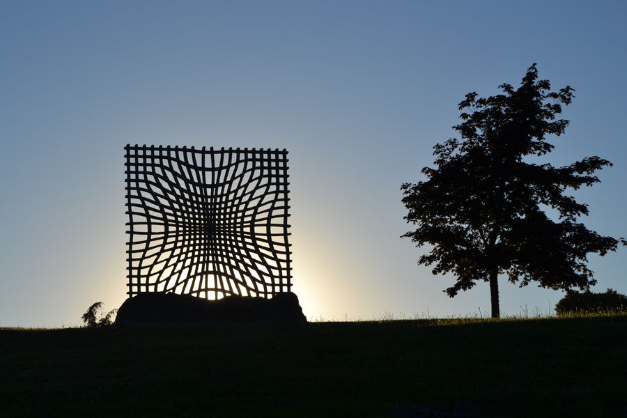
Photo credits : CD63 / Joël Damase, CD63 / Joël Damase, CD63 / Joël Damase