
Liberty Castle
Condat-lès-Montboissier
 Dogs allowed
Distance 16Km
Duration 4h30
Hiking route BOUCLE
Marking Green
In pictures


Route description
The walk takes us to the remarkable site of Château de Liberty (private) via an avenue of centuries-old trees, then on to Château de Meydat. Numerous mills bear witness to the area’s active past. Numerous views of the Cézallier and Dômes mountains.
Trail highlights
– Condat-lès-Montboissier : small village on a spur overlooking the Lastroux valley.
– 15th-century Romanesque church of Saint-Pierre aux liens.
– Liberty and Meydat castles.
– Views of the Chaînes des Puys, the Sancy massif and the Cantal mountains.
Guidebook with maps/step-by-step
Step 1 : Start from the Condat-lès-Montboissier church. Pass in front of the town hall, turn left and then right up the first tarmac track between two houses (view of the Sancy and the Chaîne des Puys on the left). At the first bend in the road, go straight ahead ; further on, turn left. Turn left. At the hamlet of Les Epines, take the track on the right. At the intersection, turn left onto a tarmac road. Cross the road and take the path through the woods.
Step 2 : Take the rightmost lane at the junction of five lanes (A-R Château de Meydat : 2nd lane on the right). 900 m further on, at the crossroads, turn left and follow the road straight ahead (view of the Sancy, the Chaîne des Puys and the Monts du Cantal). At Échaffoy, take the left-hand path downhill. Cross the stream and climb up to Bégande.
Step 3 : Cut the asphalt road and head downhill (view of the Sancy, Chaîne des Puys and Liberty castle). At Montcoudoux, 100 m after the transformer, turn right down the track into the fields. Cross the stream, walk along the ruins and reach Château de Liberty (private). Follow the driveway in front of the château (view of the Dôme and Sancy mountains). At the end of the driveway, turn left down the road. Turn right on the D39 for 70 m and follow the path down to the left towards the Boude ruins.
Step 4 : Cross the footbridge and follow an inconspicuous path that climbs to the left and then bends quickly to the right. Continue straight ahead across a field. 150 metres before Montmorin, turn left. Go straight on for 700 metres. Leave the path which climbs to the right and go down the undergrowth track opposite. After a bend, take the track on the right at the crow’s-foot. At the next junction, turn left down towards La Michinie.
Next step
Step 5 : After the hill, take the D39 to the right ; after 500 m, in a bend, go down the grassy track, cross the Astroux and continue along the road to the left. At the Fanfet mill, turn right. Take the D39 to the right at Puy Chabrol and follow the path down to the right. At the moulin de Lérissat, go back up the road and down the path to the right. Cross the Astroux twice (first on a footbridge, then on a cement bridge) before returning to the D39, which you follow to the right into Condat-lès-Montboissier.
Proposed and managed by the Conseil départemental du Puy-de-Dôme – PDIPR.
Opening hours
From 01/01 to 31/12 daily.
Subject to favorable weather.
Comfort, facilities and services
- Pets welcome
Additional information
For your own safety, always take a bottle of water, a hat, warm clothing and footwear suitable for walking.
Depending on weather conditions, certain itineraries are not recommended in bad weather (fog) or are not practicable, or even forbidden, during the winter season.
Some sites are fragile, so stay on the marked trails. Avoid picking wild flowers and disturbing wildlife. Pick up your garbage.
Animals are not allowed on some routes.
Dogs allowed Dogs must be kept on a leash due to the presence of herds.
Environment
In the country, Presence of livestock and guard dogs
Access
From Clermont-Ferrand, head for Issoire on the A75. Take exit n°15 and follow Parentignat, then Sauxillanges, and finally Condat-lès-Montboissier.
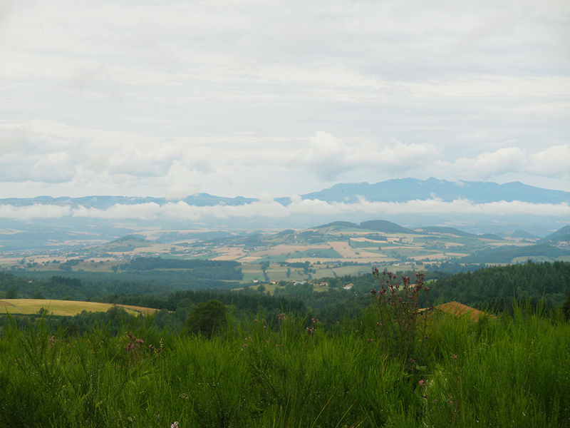
Photo credits : Conseil départemental du Puy-de-Dôme, Conseil départemental du Puy-de-Dôme, Conseil départemental du Puy-de-Dôme, Conseil départemental du Puy-de-Dôme, Conseil départemental du Puy-de-Dôme
 Updated on 2 July 2026 by Conseil départemental du Puy-de-Dôme