![]()
Le Crest
Chanonat
 Dogs allowed
Distance 11Km
Duration 3h15
Hiking route BOUCLE
Marking Yellow
In pictures
Route description
Winegrowers’ houses line the steep streets of Le Crest. Dominated by a tower, this village offers a vast panorama of the Gergovie plateau, the Allier valley, the Livradois, the Sancy and the Chaîne des Puys.
Trail highlights
– The Auzon river.
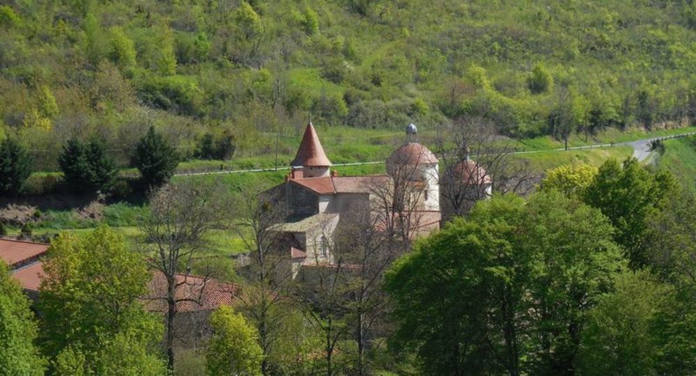
– The village of Chanonat.
– Château de la Batisse (view of the château and gardens).
– View of the Dômes mountain range, the Gergovie plateau and the Limagne plain.
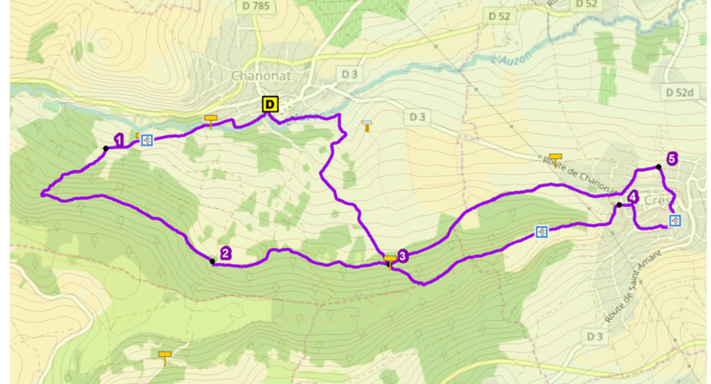
Guidebook with maps/step-by-step
Step 1 : From the start sign, walk down rue du Chabris. Before the bridge, turn right onto rue du Sault de Guillaume, which runs alongside the Auzon. At the top of the steep slope, turn left, cross the Auzon and climb the dirt track on the right (view of the gardens and Château de la Batisse), then continue to the second grassy path on the left.
Step 2 : Take the undergrowth path, follow it to a wide track and turn left. At the fork, continue right to a crossroads.
Step 3 : Go right down a wide track for about 1.5 km, ignoring the side paths, until you reach an intersection.
Step 4 : Turn right up the track. At the top of the hill, fork left onto the Chemin du Plateau de la Serre towards Le Crest (panoramic view of the Chaîne des Puys, the Plateau de Gergovie and the Limagne plain). At the fork before the village, turn left down to the church on Place du Moutier.
Next step
Step 5 : Take the lane at the corner of rue Neuve and, at the crossroads, turn right. At the junction of rue du château and rue du Muret (off-course panorama in AR to the top of the hill), go around the town hall and the château tower via rue du Muret and rue du Chemin de Ronde. Follow rue St-Esprit down the first street on your right, turn left and take the stairs on your right. Cross rue Paul Gaubin and take rue Sous les Murs, then right down rue du Bosquet to the road.
Step 6 : Turn left, then, at the fork, leave chemin de la Belette and turn left to the D3 road. Follow this to the right for 20 m, then turn left onto the Chemin du Thuel St Pierre. Stay on the main road for approx. 1.6 km, until you reach the intersection already mentioned in point 3. Go downhill to the right and, at a fork in the road, turn right. Turn left at the first T-junction and left again at the second. Follow the stream and cross it by a footbridge. Follow rue de la Fondette back to the starting point.
Proposed and managed by the Conseil départemental du Puy-de-Dôme – PDIPR.
/* col-6_sm-12 */ ?>
Opening hours
From 01/01 to 31/12 daily.
Subject to favorable weather.
Comfort, facilities and services
- Pets welcome
Additional information
For your own safety, always take a bottle of water, a hat, warm clothing and footwear suitable for walking.
Depending on weather conditions, certain itineraries are not recommended in bad weather (fog) or are not practicable, or even forbidden, during the winter season.
Some sites are fragile, so stay on the marked trails. Avoid picking wild flowers and disturbing wildlife. Pick up your garbage.
Animals are not allowed on some routes.
Dogs allowed Dogs must be kept on a leash due to the presence of herds.
Environment
In the country, Forest location, Mountain view, Presence of livestock and guard dogs
Access
From Clermont-Ferrand, take the D89 towards Le Mont-Dore. After Saulzet-le-Chaud, turn left on the D120 towards Opme, and continue as far as Chanonat. Parking lot behind the town hall.
Downloadable :
You might also like…
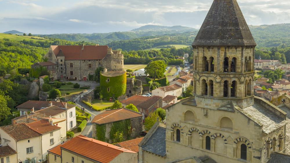
Photo credits : CD63 / C.Bachelerie, Conseil départemental du Puy-de-Dôme