
Le Marais
Aigueperse
 No dogs allowed
Distance 25Km
Duration 6h00
Hiking route BOUCLE
Marking Yellow markings (symbol : two dots and a triangle)
In pictures


Route description
This circuit, with its contrasting landscapes, first surveys the hills overlooking the Limagne plain, from Chaptuzat to Artonne, before plunging into the coolness of the Morge banks and returning to Aigueperse via “le marais”.
Guidebook with maps/step-by-step
Step 1 : Departure : Take Boulevard de la Magdeleine to cross the D2009 (15th-century Ste-Chapelle 200 m on right). Turn left at the 4th street, allée de la chapelle. At the crossroads on the right, head for Montpensier (you’ll pass under the bridge). After the dovecote, take chemin des Acacias, then rue du Paqueret.
Step 2 : Variant : top of hillock, orientation board and rest area on right. Join the Place de la Forge (well and rest area). At the end of Rue du Pré Chatelain, cross the D2009 and take the left-hand path. Go straight ahead and cross the D439. Pass the rest area (viewpoint) and fork right (old limestone quarry area).
Step 3 : Go around the water tower and a few hundred metres further on, turn left at the crossroads to reach Chaptuzat Haut. Cross the D12 and take the track opposite. After leaving two crossroads, discover two crosses set into a wall, go straight ahead (viewpoint) towards Château de la Roche (11th & 14th centuries) and turn left at the first crossroads. At the transformer, turn right into Bens. Leave the village and head for Glénas (shortcut towards Aigueperse). As you leave the village, you’ll see a panoramic view of the Château de St-Cirgue.
Step 4 : Enter Artonne on the Chemin des Puys and turn left at the fountain (winegrowers’ houses). Go down the boulevard, turn left onto the chemin du Billaudou, then right onto the route de Combronde for around 100 metres. Turn left onto the chemin des jardiniers. This descends to a cross, where you turn right. Cross the bridge over the Morge and take the left-hand path through the fields. Turn left at the large crossroads, then cross the Morge again.
Next step
Step 5 : Go past the Montclar mill and at the crossroads turn right onto the D22 (view over the cultivated marshland) to the track on the left before the railroad bridge. Continue as far as La Raynaude and stay on the road (do not cross the railroad line), then turn right, go straight on as far as the hamlet of Bellecombe, then turn left, then right.
Step 6 : Follow the D985 as far as the level crossing, then turn left before “le Premier Pont”. At the next crossroads, turn left and cross the railroad line and the D985 again. Follow the signs for La Mange, then cross two roads (the second being the D12). At the next junction, turn right, then left, to enter Aigueperse. Return to the starting point.
Opening hours
All year round daily.
Additional information
Departure is from the covered washhouse near the caravan park.
Environment
In the country, Village centre, Panoramic view
Downloadable :
You might also like…
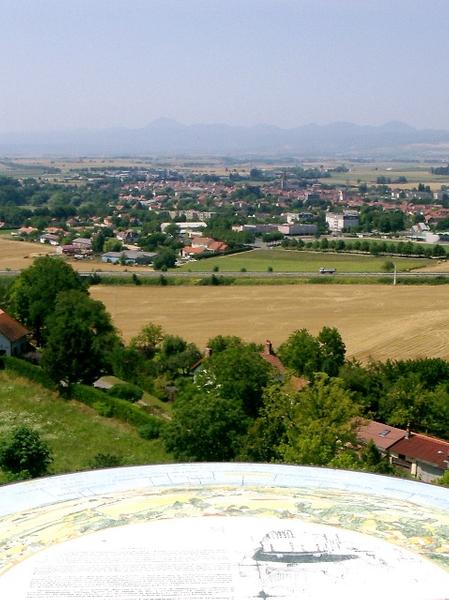
Photo credits : Communauté de communes Plaine Limagne, Communauté de communes Plaine Limagne, Communauté de communes Plaine Limagne, Communauté de communes Plaine Limagne
 Updated on 18 December 2025 by Office de Tourisme Terra Volcana, les Pays de Volvic