![]()
Le Puy de Cimard
Chanonat
 No dogs allowed
Distance 6.7Km
Duration 2h30
Hiking route BOUCLE
Marking Easy level – yellow (apple) markings
In pictures

Route description
Departing from the village of Chanonat, this hike will first introduce you to the medieval heritage of the village of Chanonat, then to the characteristic landscapes of the Limagne fault valleys, a UNESCO World Heritage Site since 2018.
How to get there : From Clermont-Ferrand, follow Montpellier on the A75 freeway. Take exit 4 towards La Roche Blanche. Follow the D978 to the Orcet crossroads. Turn right onto the D52 as far as the Chanonat bypass. Park in the parking lot at the crossroads with the route d’Opme, in(…)
Trail highlights
Mountain bike accessible (easy level)
We recommend that you follow the route with the Mikhes app, which guides you step by step for a simplified discovery. Download the app at the bottom of the page and start your tour.
Guidebook with maps/step-by-step
Step 1 : Take rue Saint-Pierre to the Place de l’Église, a Romanesque building that has been altered over the centuries (12th-15th centuries). Via rue de la Mission, enter the public garden for a view of the former presbytery, part of the vast complex of the Hospitaller commandery. Then on to Place Delille, where the 1827 fountain bears a verse inscription in honor of the poet who spent his childhood in Chanonat. Continue along rue Savaron to chemin de Tantène.
Step 2 : After the bridge, drive along all the buildings of the Commanderie. The rest of the way through Chanonat follows the course of the Auzon to the Chabris point.
The natural part of the route is typical of the landscape of the Limagne fault : a deeply incised stream with the inverted relief of the Montagne de la Serre to the south, a relief formed by a very ancient volcanic flow (3.6 million years old), and to the north the puy Giroux and the puy de Cimard (remnants of volcanic eruptions of the same date).
Chanonat is partly built on a more recent volcanic flow (60,000 years old).
/* col-6_sm-12 */ ?>
Opening hours
All year round daily.
Downloadable :
You might also like…
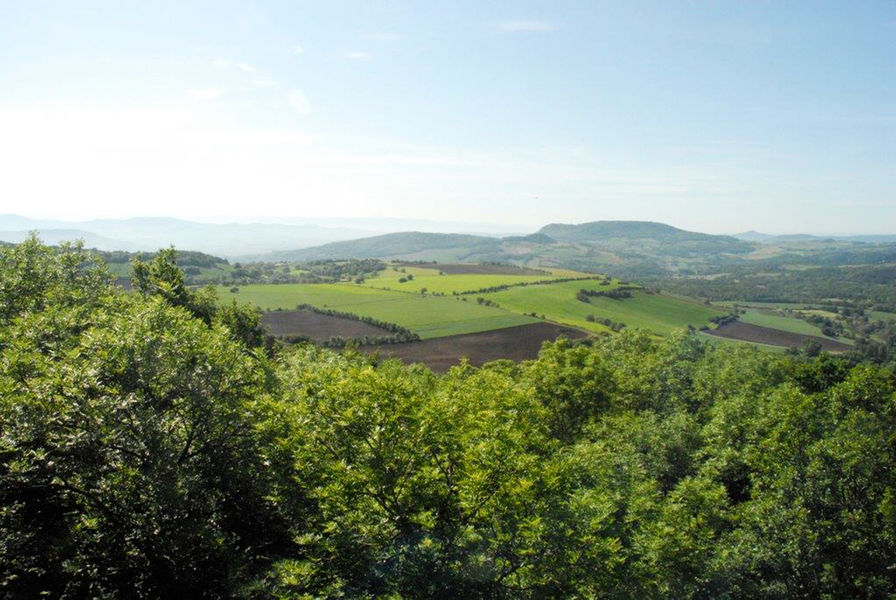
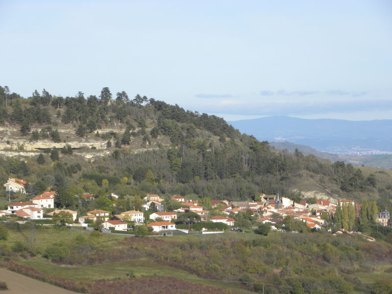
Photo credits : Mond’Arverne Tourisme