
Puy-de-Dôme variant of the Tour des Vaches Rouges
Anzat-le-Luguet
 No dogs allowed
Distance 48.5Km
Duration 7h40
Hiking route ALLER_ITINERANCE
Marking Markings : red cow heads.
In pictures


Route description
The Tour des Vaches Rouges is a hiking trail in the Cézallier. The complete tour covers 135 to 181 kms. A Puy-de-Dôme variant is available for a 48.5km loop.
The Puy-de-Dôme variant : Brion-Bas – Rentières – Ardes – Mazoires – Parrot
Splendid panoramas alternate between the Rentières valley and the Aigle rock, the Strougoux caves, the Margeride, the Artout cirque, the Signal du Luguet, the Sancy massif, the Puy de Dôme and the Chaîne des Puys, as well(…)
Trail highlights
– For your safety, please check the weather forecast before setting off on your hike.
– To preserve the environment in which you are located, please avoid leaving your garbage in nature.
– Remember to take equipment adapted to the weather conditions and the hiking itinerary (hiking boots, water bottle, cap, sunglasses, jacket…).
Guidebook with maps/step-by-step
Step 63 : Departure point : Go down towards the RD 36, cross it and continue straight ahead. Leave a track on your right. Cross the stream on a pontoon bridge and rejoin the path. Continue as far as La Cabane. Take the D126 (towards Ardes-sur-Couze) for 20 m, then the D142 (towards Rentières). 30 m before a right-hand bend, turn left up the track towards the wind turbines. Go through the barrier on the right and reach wind turbine number 1 (view of the Rentières valley). Go through a 2nd barrier and, 150 m further on, a 3rd at road level. Follow the road to the left, until you reach the metal barrier at the ferme du Coq on the right.
Step 1 : Follow the road to the left. Pass through Chalagnat and continue on the road (view of the Rentières valley/Aigle rock) to the last hamlet (Granges). At the end of the bend, take the path to the right (view of the Strougoux caves). Cross a stream. At the fork, continue uphill to the left (possibility of descending to the right as far as the Sainte-Pezade chapel, 15 min AR, picnic table). Leave a path on the right. At the next fork, turn left and climb up to a road at the entrance to a village (Mazoires). Turn left, pass the church on the right and 150 m further on, turn right onto a wide track. Ignore all side roads until you reach a T-junction.
Step 2 : Go left up the forest road to an intersection at the edge of the forest. Turn right. At the 2nd Canadian crossing, turn left. Leave a track on the right (view of the Margeride). Follow the edge of the forest to a small hunters’ watchtower. 20 m after the watchtower, turn left, then left 2 more times, until you reach a T-junction (point 1245 m).
Step 3 : Go right. At the crossroads of 4 paths, continue straight on to the Parrot parking lot (after leaving the woods, panoramic view of the cirque d’Artout, Signal du Luguet, Sancy massif, puy de Dôme and Chaîne des Puys).
NB : At this point, the variant ends ; you return to the “Tour des Vaches Rouges” circuit.
Next step
Step 4 : From the parking lot, turn left and follow the road towards Le Buffier. At a ruined house, take the path on the left. After a right-hand bend (view from Forez to La Margeride and the Mézenc), continue downhill (view of the cirque d’Artoux), then cross a stream. At the fork, turn left and climb up to a road. Cross the road and turn left onto the wide track. Go through the village of Le Luguet to the chapel (picnic table).
Opening hours
From 01/01 to 31/12 daily.
Open from May to October.
Subject to favorable weather.
Additional information
For your own safety, always take a bottle of water, a hat, warm clothing and footwear suitable for walking.
Depending on weather conditions, certain itineraries are not recommended in bad weather (fog) or are not practicable, or even forbidden, during the winter season.
Bivouacs : during daylight saving time, tents must be pitched after 8 p.m. and dismantled before 8 a.m. The bivouac site must be located at the edge of the forest, excluding the slopes, craters and summits of volcanoes, unless otherwise indicated on the site. The agreement of the landowner must be sought.
Open-air fires are permitted in specially designated areas. Otherwise, all fires are prohibited within 200 m of the edge of a wood or forest, or under the terms of a prefectoral decree.
The use of portable gas stoves is nevertheless tolerated, in a setting that is as safe as possible (stable, away from flammable materials, etc.).
Stay on marked trails. Respect private property.
Bring your own rubbish bags for picnics, snacks and other waste, and use the containers available at most parking lots.
Do not disturb wildlife.
Don’t pick flowers, as many are protected (even those that seem very ordinary or common).
Environment
In the country, Mountain view, Village -2 km away, In a nature reserve, Presence of livestock and guard dogs
Downloadable :
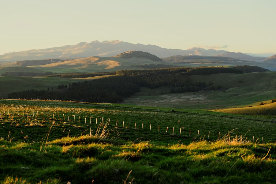
Photo credits : Norbert Dutranoy, Marlène Gaydier, Gwenaelle Douard
 Updated on 8 April 2026 by Auvergne Pays d’Issoire