![]()
Tour of Puy de Como
Saint-Ours
 Dogs allowed
Distance 6Km
Duration 1h45
Hiking route BOUCLE
Marking Blue
In pictures
Route description
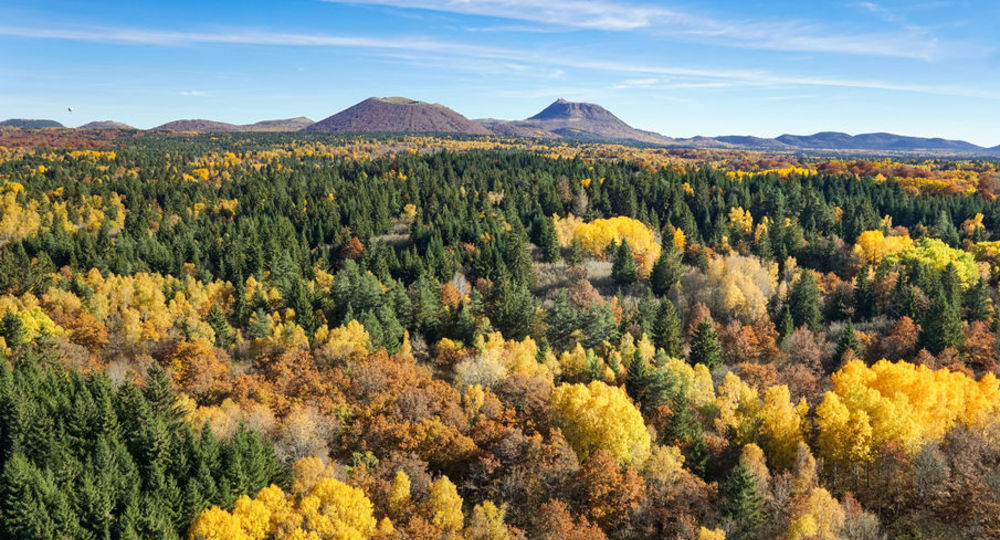
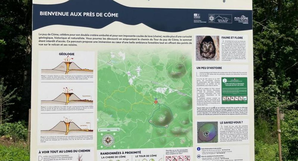
At 1,252 m, Puy de Côme is the 2nd largest volcano in the Chaîne des Puys.
Trail highlights
– View of the Côme and Clersou puys.
– View of Grand Suchet.
– Vulcania and Lemptégy volcano nearby.
Guidebook with maps/step-by-step
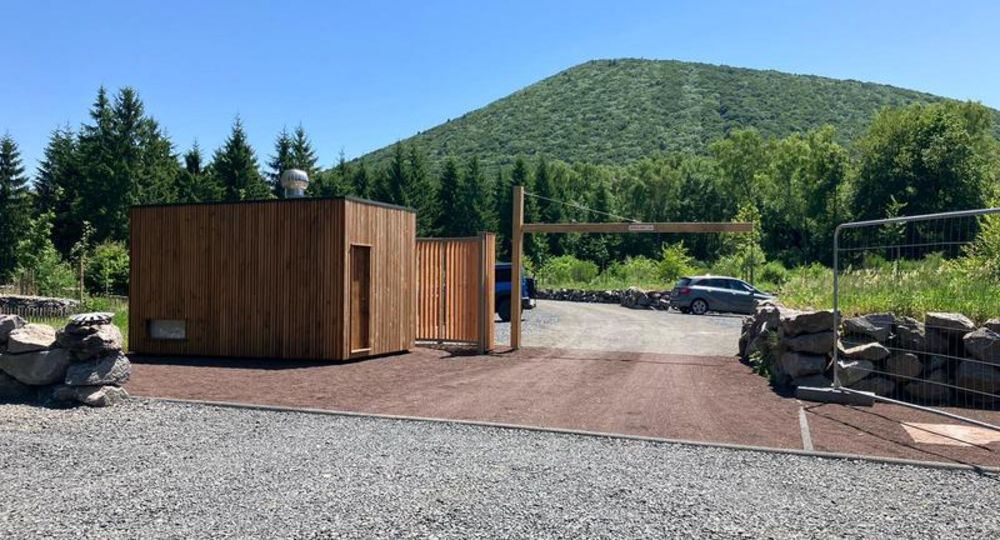
Step 1 : From the parking lot, return to the road. Cross the road and take the gravel path opposite to a bend where a footpath emerges.
Step 2 : Stay on the main path. After 100 m (view of Puy de Côme), turn right onto the path beneath the trees. After passing through the beech forest, the path gradually rises to a crossroads. Continue uphill to the right, then descend slightly to a flat area (views of Grand Suchet and Puy de Cliersou). At the T-junction, climb right to a clearing blocked by a fence.
Step 3 : Continue uphill to the left, skirting the fence. After the high point (view of the puy de Côme double cone), descend, keeping the fence to your right. Ignore a path on the left. At the flat, the path curves to the left away from the fence. Leave an enclosed track on the right. Go down the path, which is hollow and steep at the start, until you reach a fork in the road.
Step 4 : Take the right-hand path, then join a wide track which you take to the right for 200 m. Leave it for a right-hand path in the forest (not very visible in advance). This path, sometimes uphill or downhill, often flat, winds through the forest, passing several ruined charcoal kilns. After crossing a pine forest, come to a crossroads (point 1). Take the gravel path opposite, and cross the road to reach the parking lot.
Proposed and managed by the Conseil départemental du Puy-de-Dôme – PDIPR.
/* col-6_sm-12 */ ?>
Opening hours
From 01/01 to 31/12 daily.
Subject to favorable weather.
Comfort, facilities and services
- Pets welcome
Additional information
For your own safety, always take a bottle of water, a hat, warm clothing and footwear suitable for walking.
Depending on weather conditions, certain itineraries are not recommended in bad weather (fog) or are not practicable, or even forbidden, during the winter season.
Some sites are fragile, so stay on the marked trails. Avoid picking wild flowers and disturbing wildlife. Pick up your garbage.
Animals are not allowed on some routes.
Dogs allowed Dogs must be kept on a leash due to the presence of herds.
Environment
Forest location, Presence of livestock and guard dogs
Access
From the Vulcania entrance, continue on the D559 towards Mazayes for 1.4km. Start sign / parking lot 50 m on right.
Downloadable :
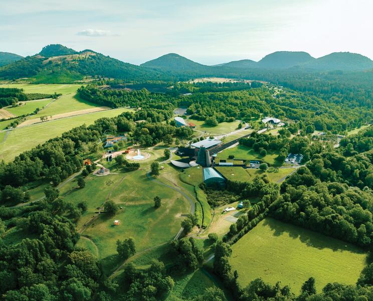
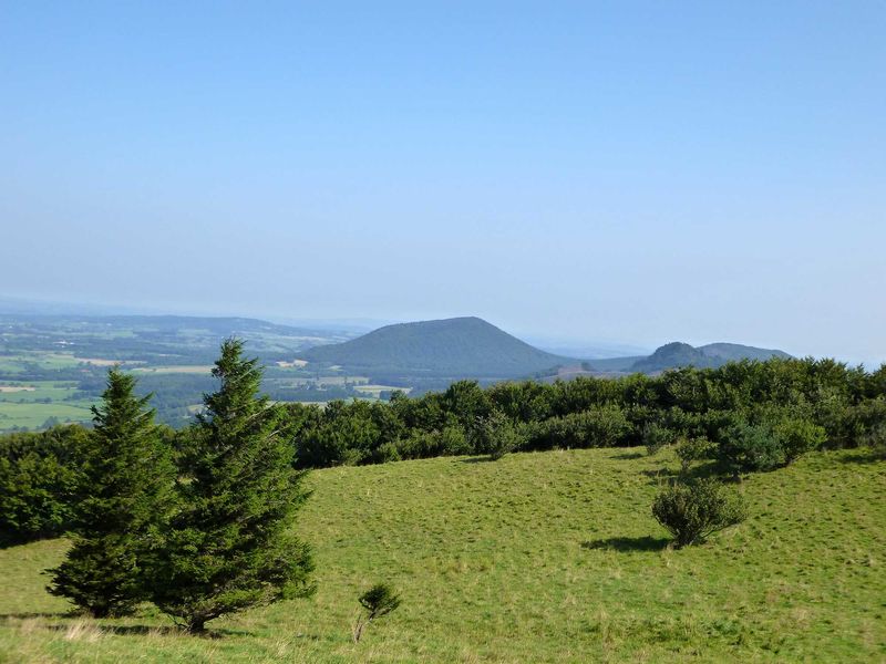
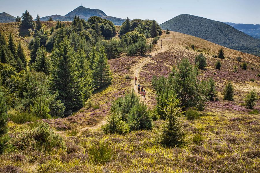
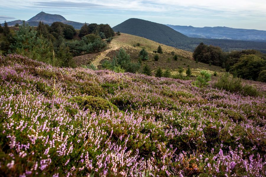
Photo credits : Francis Cormon